|
Pebble Mine site photos |
|
|
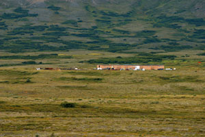
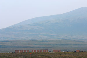
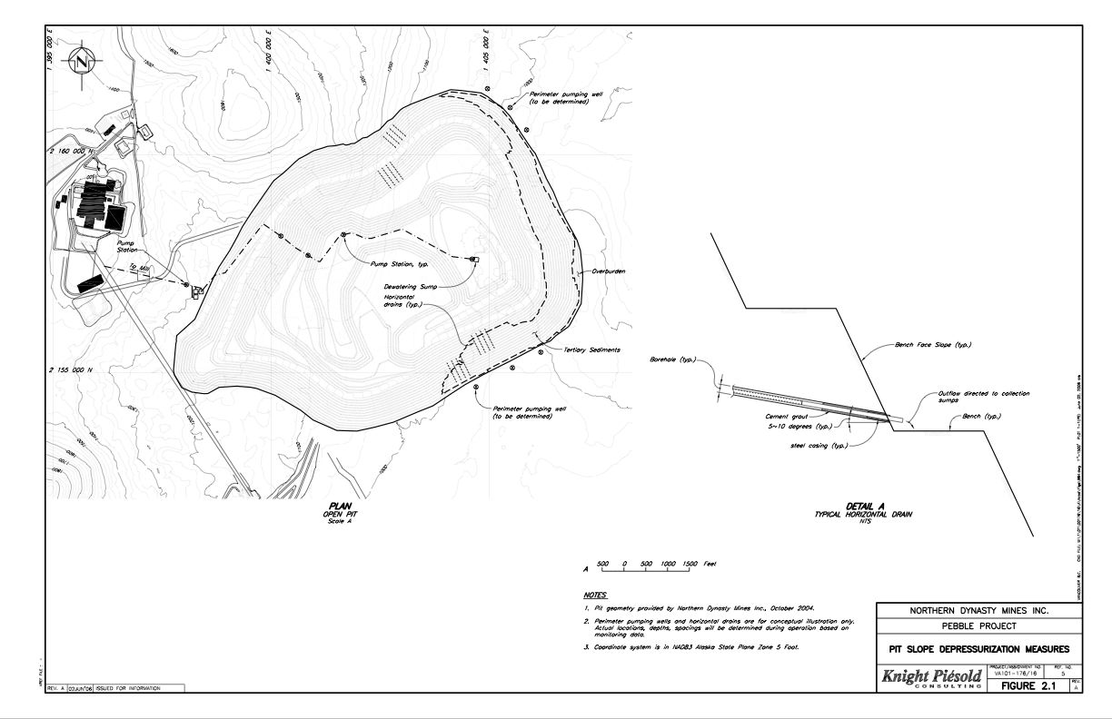
These photos are from the prospective mine site segment of my month-long, 450+ mile Trek through the Pebble Mine watersheds The Pebble Mine project is a controversial proposal by Northern Dynasty Minerals to build one of the largest gold and copper mines in the world, in southwest Alaska, near Lake Iliamna. Northern Dynasty has not yet applied for permits, but their current proposal involves both a large open pit and an underground mine, as well as removal of the water from the headwaters of Upper Talarik Creek and the Koktuli River ( important fish habitats). The site sits at the headwaters of two major Bristol Bay drainages ( Nushagak and Kvichak), and potentially poses a large threat to the region's salmon. This proposal has become a major political issue in Alaska, pitting pro-mining forces against local native villages and commercial and sport fishermen. Pictures and other files are provided free for download for non-profit use only. Please credit the photographer (Erin McKittrick). For commercial use, please contact me at mckittre at gmail dot com. My photographs of the Pebble Mine area have been published in Alaska and Fly Fisherman magazines, the Bristol Bay Times, as well as by the Renewable Resources Coalition, the Wilderness Society, the Alaska Conservation Foundation, and other environmental groupss. | |
|
Click on photo to see a larger version. Click on "high-res" to get a 2-10 Mb file for printing. | ||
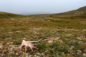
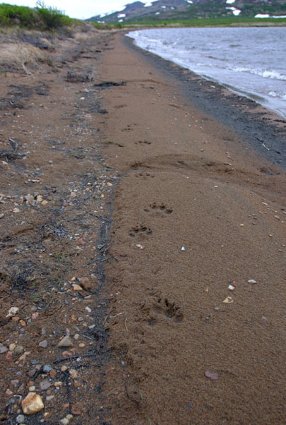 1278 - Wolf tracks on the beach at Frying Pan Lake.
|
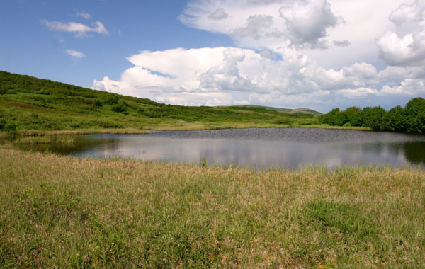
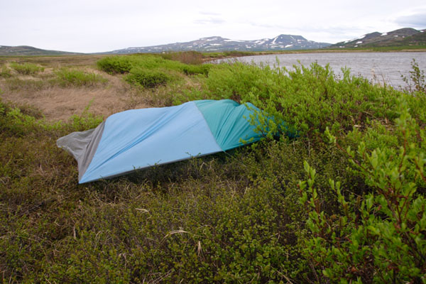 1280 - Our tarp set up on the shores of Frying Pan Lake.
|
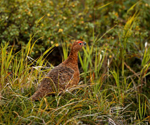
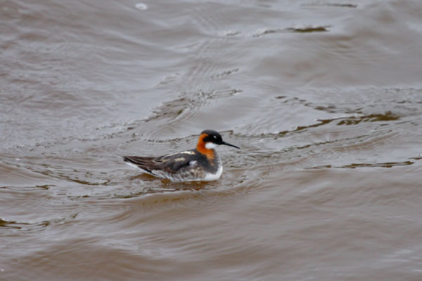 1296 - Bird on the water at Frying Pan Lake.
|
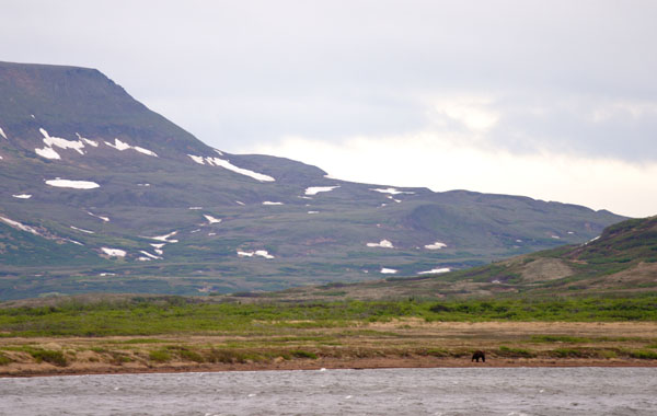 1304 - Bear on the beach of Frying Pan Lake.
|
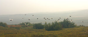
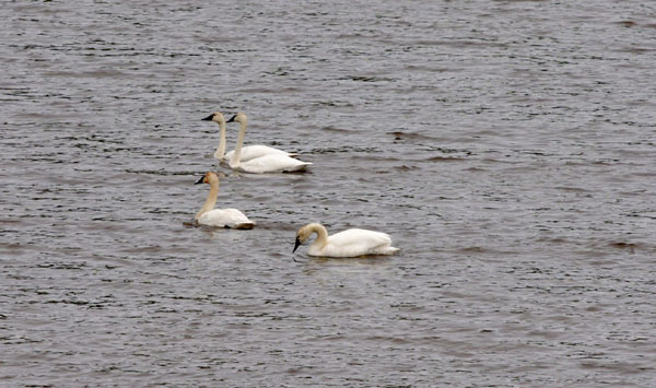 1309 - Swans on Frying Pan Lake.
|
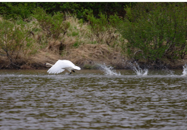 1316 - Swans taking off from the handle of Frying Pan Lake.
|
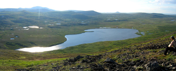 3033 - Hiker overlooking Frying Pan Lake, from a ridge that would be underneath the tailings lake.
|
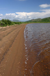
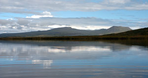
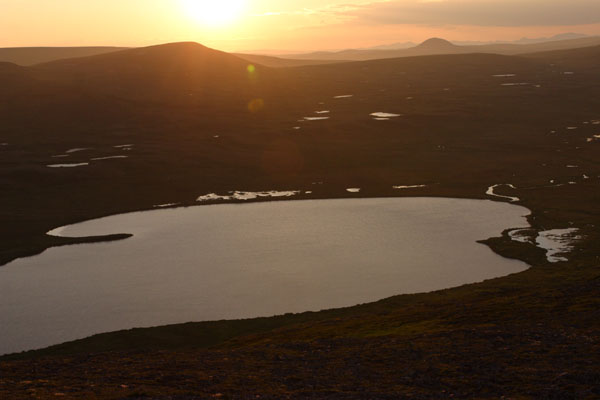 3038 - Sunset on Frying Pan Lake.
|
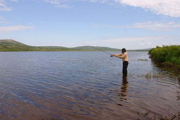
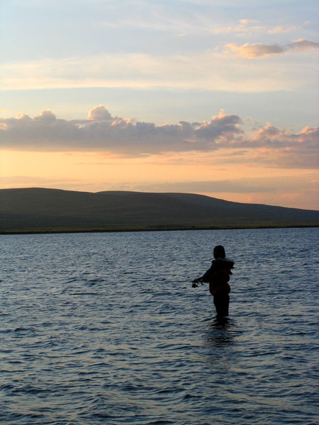 1491 - Fishing at sunset in Frying Pan Lake.
|
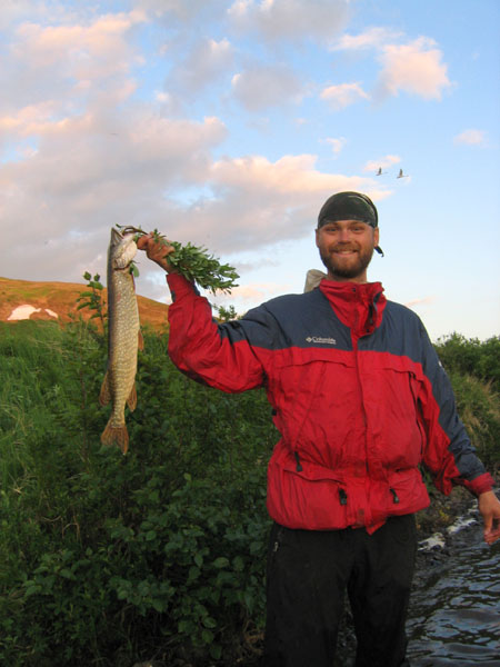 1494 - Northern Pike caught in Frying Pan Lake.
|
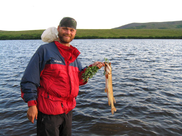 1496 - Northern Pike caught in Frying Pan Lake.
|
 3054 - Fishing on Frying Pan Lake.
|
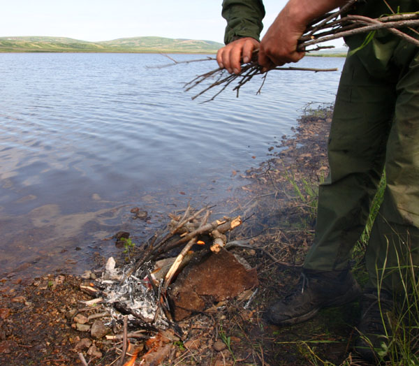 3063 - Building a fire to cook a pike on Frying Pan Lake.
|
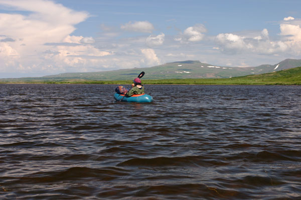 3074 - Paddling an Alpacka raft on Frying Pan Lake, looking North.
|
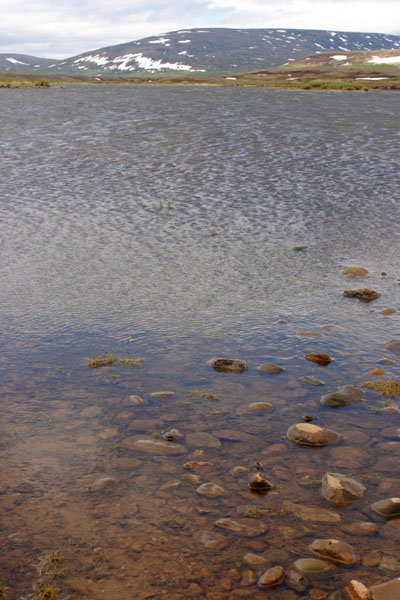
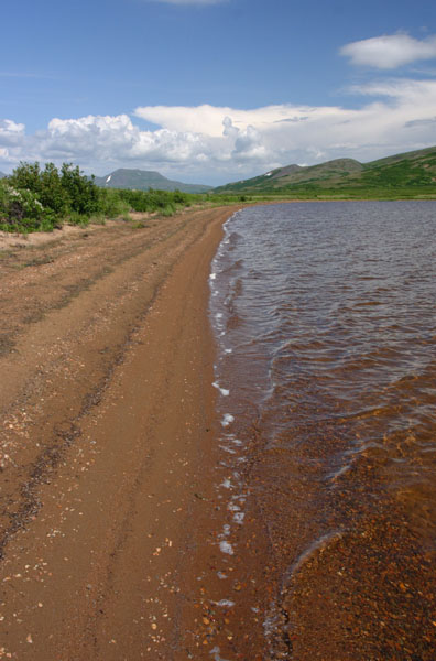 3091 - Shore of Frying Pan Lake.
|
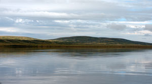
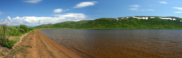 3090 - Northeast corner of Frying Pan Lake.
|
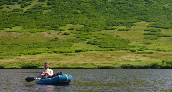 3082 - Fishing from an Alpacka raft on Frying Pan Lake.
|
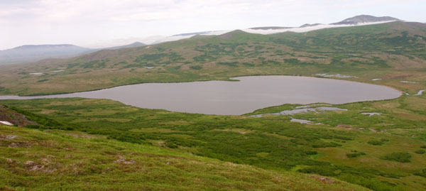 3048 - Looking down on Frying Pan Lake, from the east.
|
 3100 - Looking down on Frying Pan Lake, from the west.
|
||
|
Click on photo to see a larger version. Click on "high-res" to get a 2-10 Mb file for printing. | ||
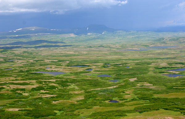
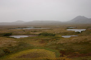
 3099 - One of the hundreds of small lakes and ponds in the mine site valley.
|
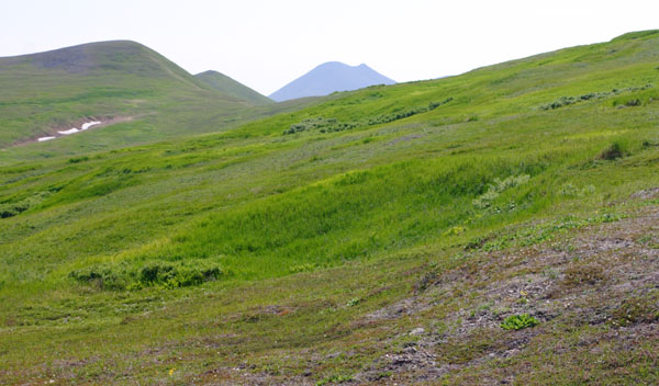 3103 - Sharp Mtn poking above a grassy ridge on the west edge of the mine site.
|
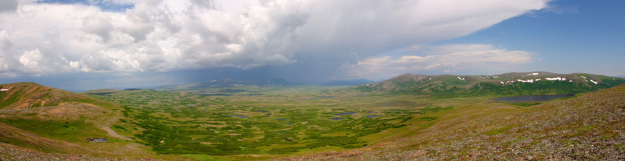
 3105 - Looking over the mine site valley and exploration drill rigs to a thunderstorm approaching over Groundhog Mtn.
|
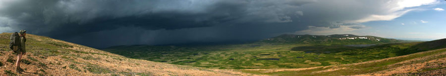
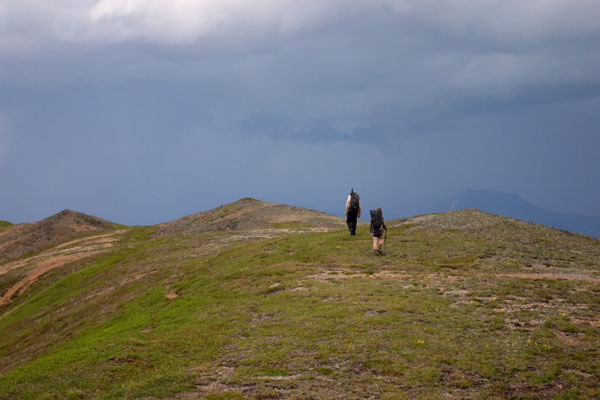 3115 - Hikers against the dark clouds of a thunderstorm, Pebble West.
|
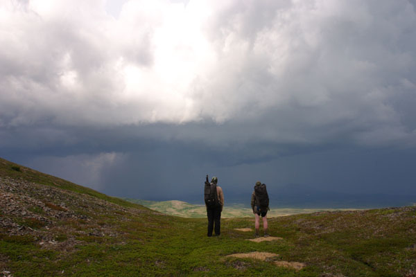 3117 - Hikers watching an approaching thunderstorm over the mine site, Pebble West.
|
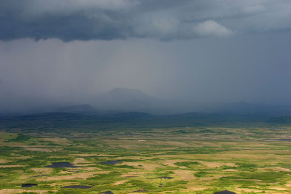 3127 - Thunderstrom approaching the mine site from Groundhog Mtn, drill rigs glowing against the dark clouds.
|
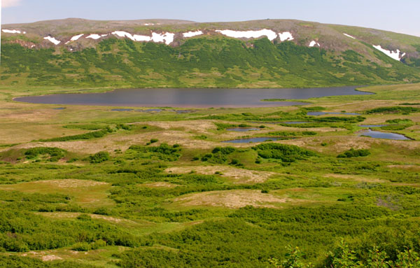
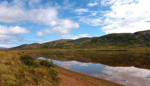
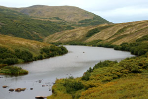
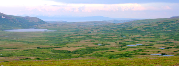 3161 - Looking over Pebble West, Frying Pan Lake, and Lake Iliamna in the background.
|
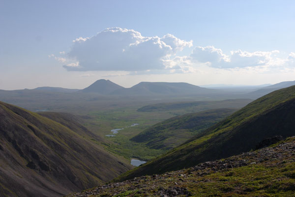
 3259 - Looking over the headwaters of Upper Talarik Creek from Groundhog Mtn, with the mine site, Frying Pan Lake, and Sharp Mtn in background.
|
|
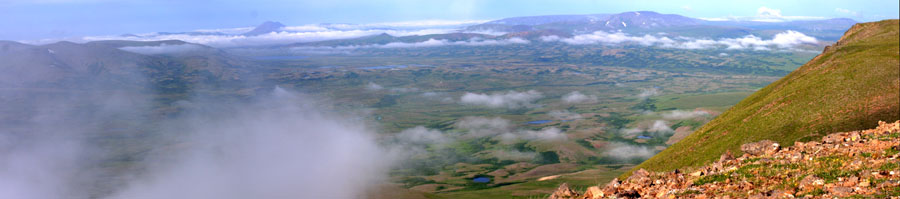 3253 - Looking over the headwaters of Upper Talarik Creek from Groundhog Mtn, with the mine site, Frying Pan Lake, and Sharp Mtn in background.
|
||
 3120 - Looking east across the mine site valley just before a thunderstorm, Frying Pan Lake on the right, Upper Talarik Creek valley under clouds on the left.
|
||
 3121 - Looking across to Groundhog Mtn from the west side of the mine site, Frying Pan Lake to the right.
|
||
|
Click on photo to see a larger version. Click on "high-res" to get a 2-10 Mb file for printing. | ||
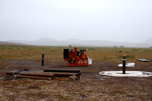
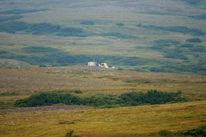
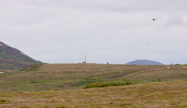 1189 - Drill rigs and helicopter on the divide between Upper Talarik Creek and the South Fork Koktuli River, Pebble East.
|
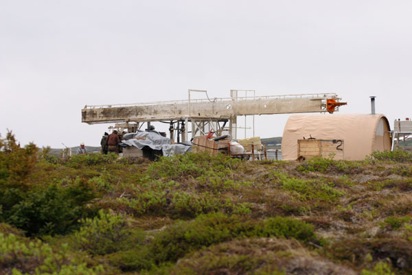 1212 - Drill rig being set up at Pebble East.
|
 1219 - Oily puddles left behind at an old drill rig site, Pebble East.
|
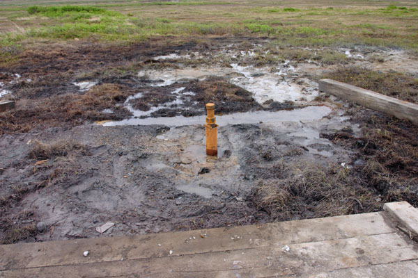 1227 - Oily puddles left behind at an old drill rig site, Pebble East.
|
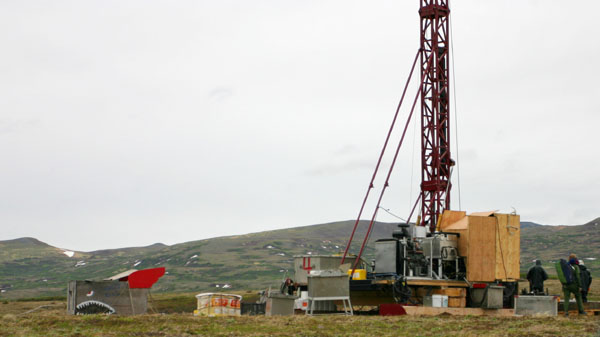 1232 - Exploration drill rig at Pebble East.
|
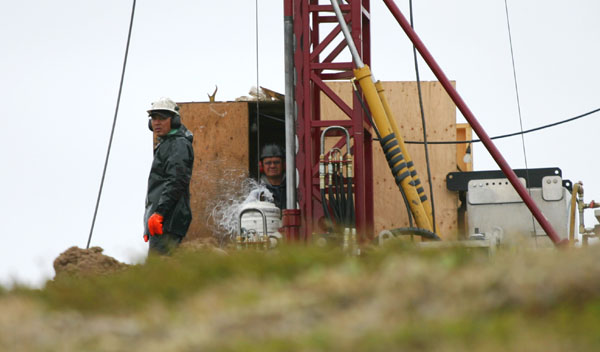 1237 - Workers and spurts of water at a drill rig, Pebble East.
|
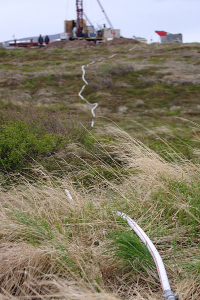 1239 - Drill rig, with slurry hose leading down to the tundra, Pebble East.
|
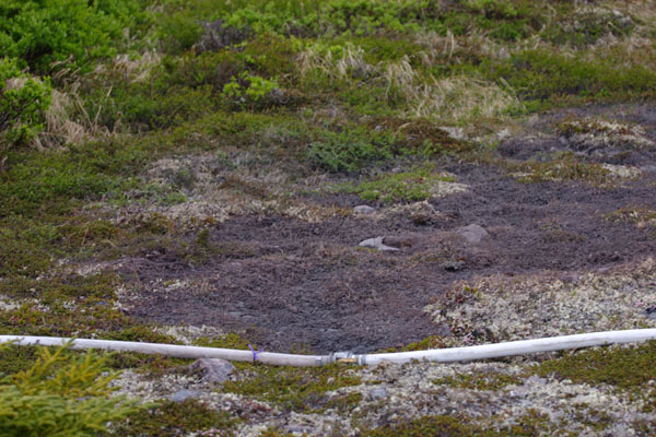 1240 - Tundra killed by a leak in a drill rig hose, Pebble East.
|
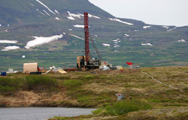 1248 - Drill rig on the divide between Upper Talarik Creek and South Fork Koktuli River, Pebble East.
|
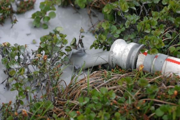 1249 - Drill rig hose dumping grey slurry into the tundra, Pebble East.
|
 1254 - Drill rig hose dumping grey slurry into the tundra, Pebble East.
|
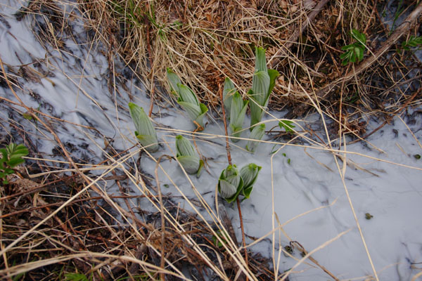 1257 - Drill slurry running over false hellebore shoots, Pebble East.
|
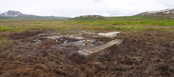
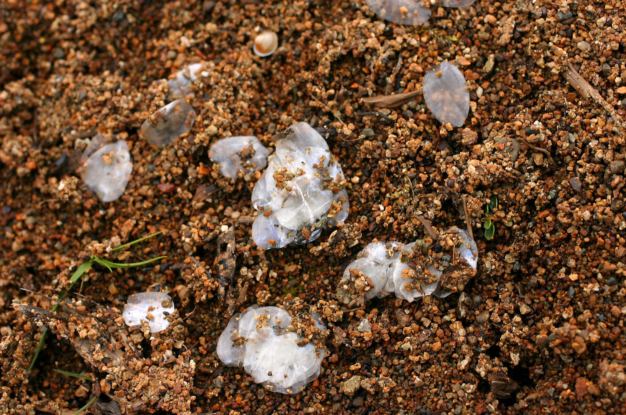
 1266 - Monitoring wells in the tailings lake area.
|
 1269 - Blast crater in the tundra, tailings lake area.
|
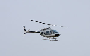
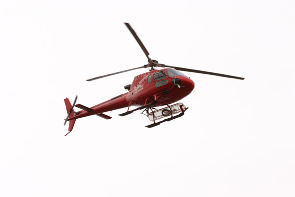 1332 - Northern Dynasty helicopter buzzing over the mine site.
|
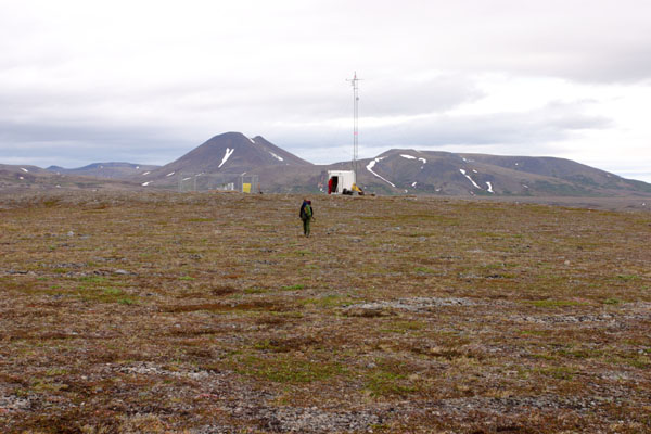
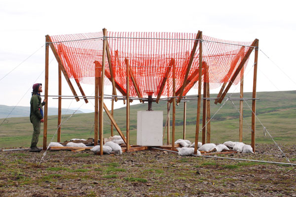 3142 - Rain gauge at a weather station on the ridge over Pebble West.
|
||
|
Click on photo to see a larger version. Click on "high-res" to get a 2-10 Mb file for printing. | ||
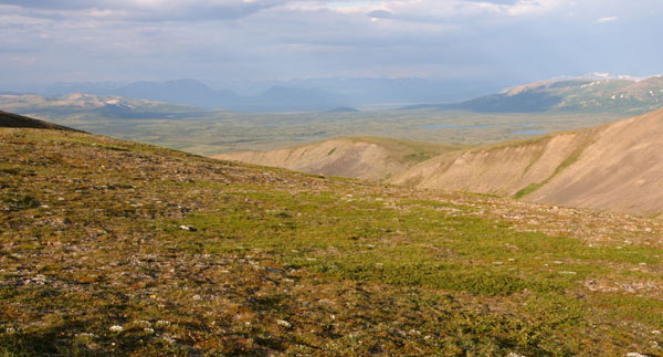
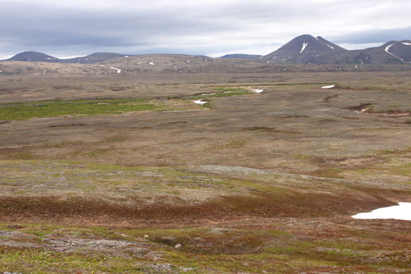
 2980 - Upper Koktuli valley and Sharp Mtn, from the ridge between Upper Talarik and the mine site.
|
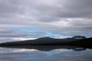
 2996 - Looking across Upper Talarik Creek valley to the Newhalen River valley and Lake Iliamna.
|
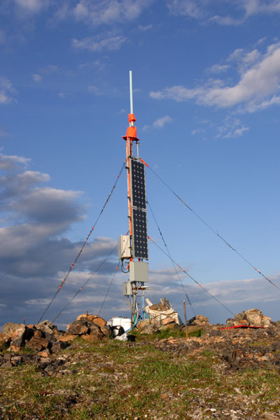 2997 - Weather station on a high peak over the mine site.
|
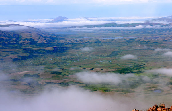
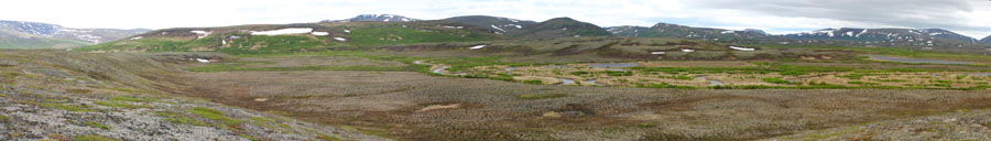
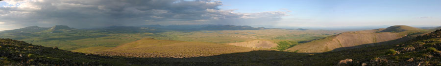 3001 - Panorama from a peak over the mine site, looking at Groundhog Mtn, Upper Talarik Creek valley, and Lake Iliamna.
|
||
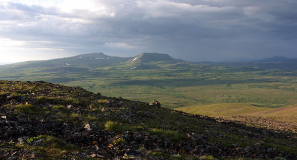 3002 - Upper Talarik Creek valley and Groundhog Mtn, from a high peak over the mine site.
|
 3034 - Sunset on the ridges over the mine sie.
|
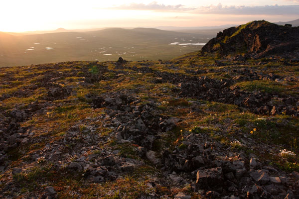 3035 - Sunset on the ridge overlooking the mine site, shining lakes in the proposed pit area in the background.
|
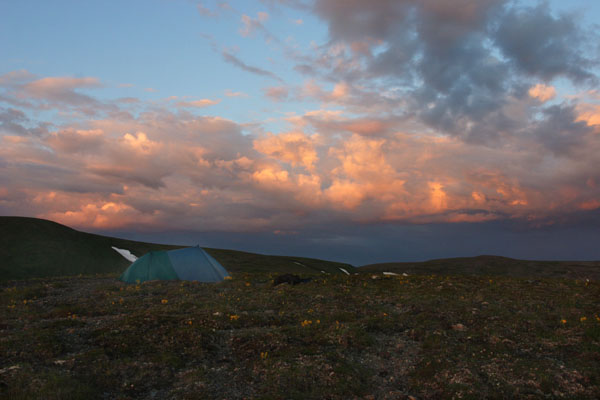 3040 - Tarp on a ridge above Frying Pan Lake.
|
||
|
Click on photo to see a larger version. Click on "high-res" to get a 2-10 Mb file for printing. | ||
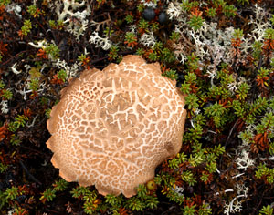
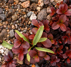
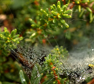
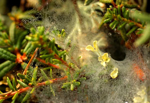
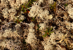
 1323 - Mosses and rock in the tundra, tailings lake area.
|
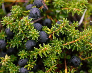
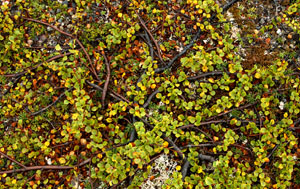
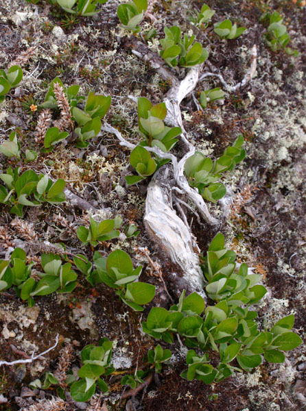 1329 - Dwarf willow, tailings lake area.
|
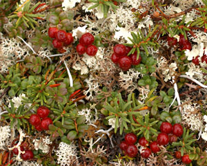
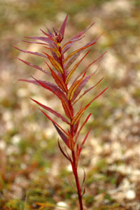
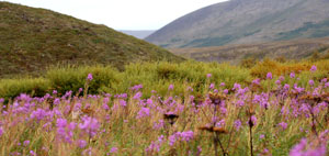
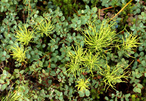
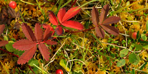
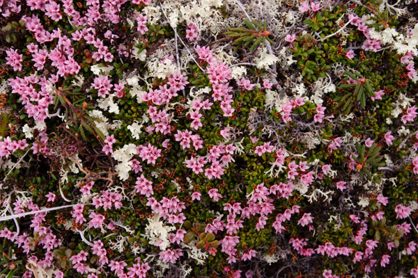 1351 - Pink flowers in the June tundra, tailings lake area.
|
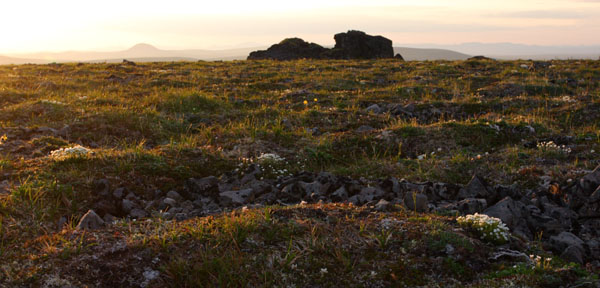
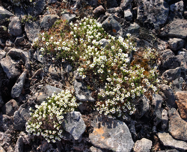 2986 - Tiny wildflowers on a high rocky ridge above the mine site.
|
||
|
Click on photo to see a larger version. Click on "high-res" to get a 2-10 Mb file for printing. | ||
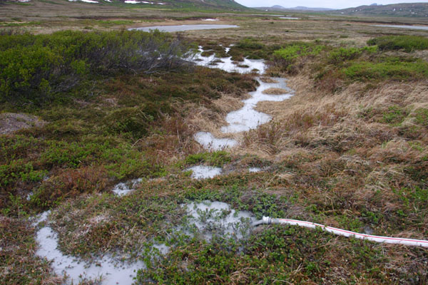
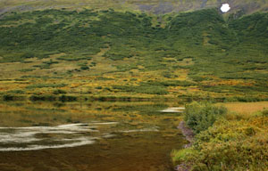
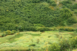
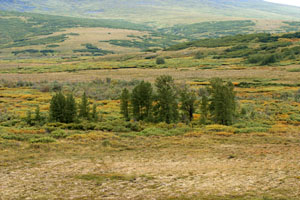
 1340 - Headwaters of the Koktuli River, tailings lake area.
|
 1344 - Headwaters of the Koktuli River, tailings lake area.
|
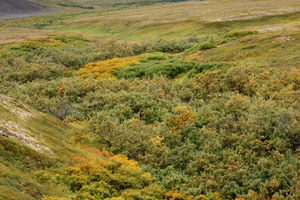
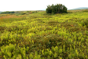
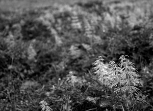
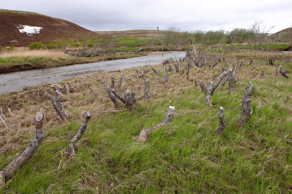 1346 - Beaver clearcut at the headwaters of the Koktuli River.
|
 1352 - Approaching a weather station on the hill, tailings lake area.
|
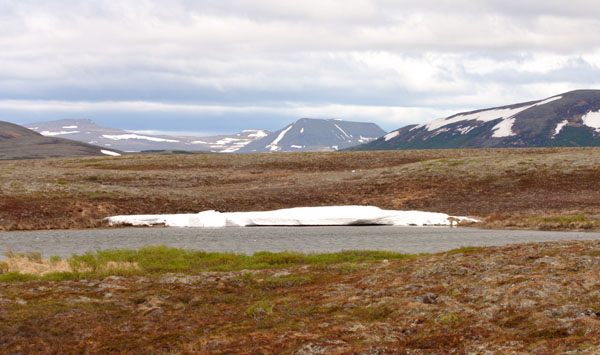
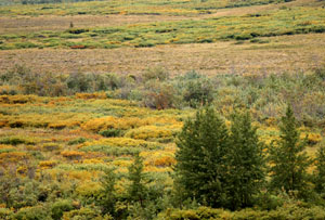
 1379 - Small tundra lakes near the upper Koktuli River, tailings lake area.
|
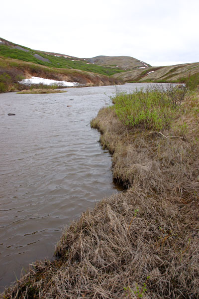
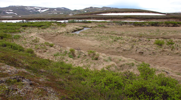
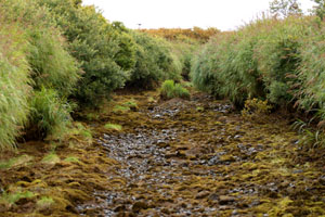
 1380 - The upper Koktuli River, a green ribbon snaking through the plains of tundra, tailings lake area.
|
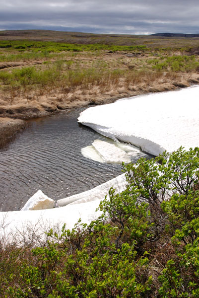 1381 - Last of the snow melting from the banks of the upper Koktuli River, tailings lake area.
|
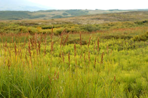
 1383 - Windblown grassy banks of the upper South Fork Koktuli River.
|
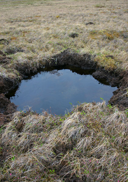
 1385 - Tundra lake near the headwaters of the South Fork Koktuli River.
|
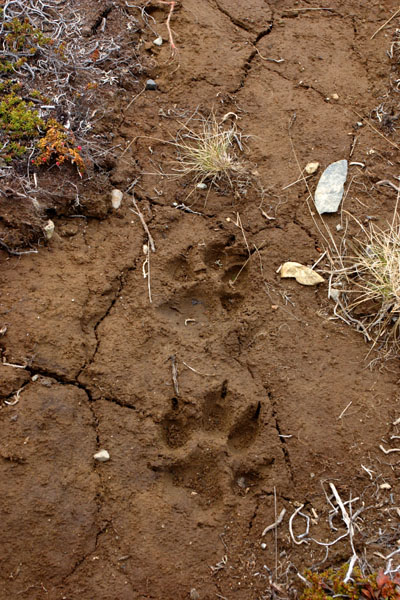 1386 - Wolf tracks on a muddy beach, tailings lake area.
|
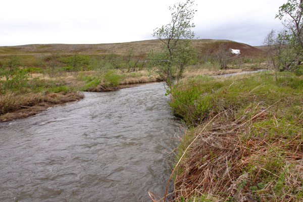
 1387 - Tundra and mountains surrounding the South Fork Koktuli River, just downstream of the proposed tailings lake.
|
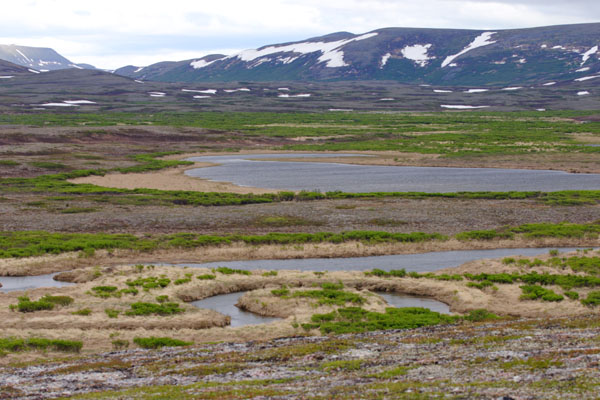 1394 - Meandering bends of the South Fork Koktuli River, just downstream of the proposed tailings lake.
|
 1395 - Meandering headwaters of the South Fork Koktuli River, just downstream of the proposed tailings lake.
|
||
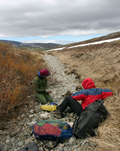 1403 - Lunch stop in a dry gully, just beyond the tailings lake area.
|
||
|
| ||
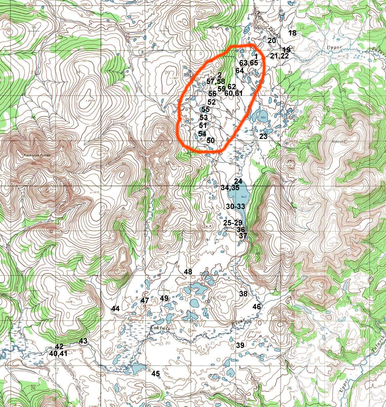
| Pictures taken near Frying Pan lake (in the proposed tailings lake area). Map of photo locations. |
||
|
|
|
|
|
|
|
|
|
|
|
|
|
|
|
|
|
|
||
|
|
|
|
|
| ||
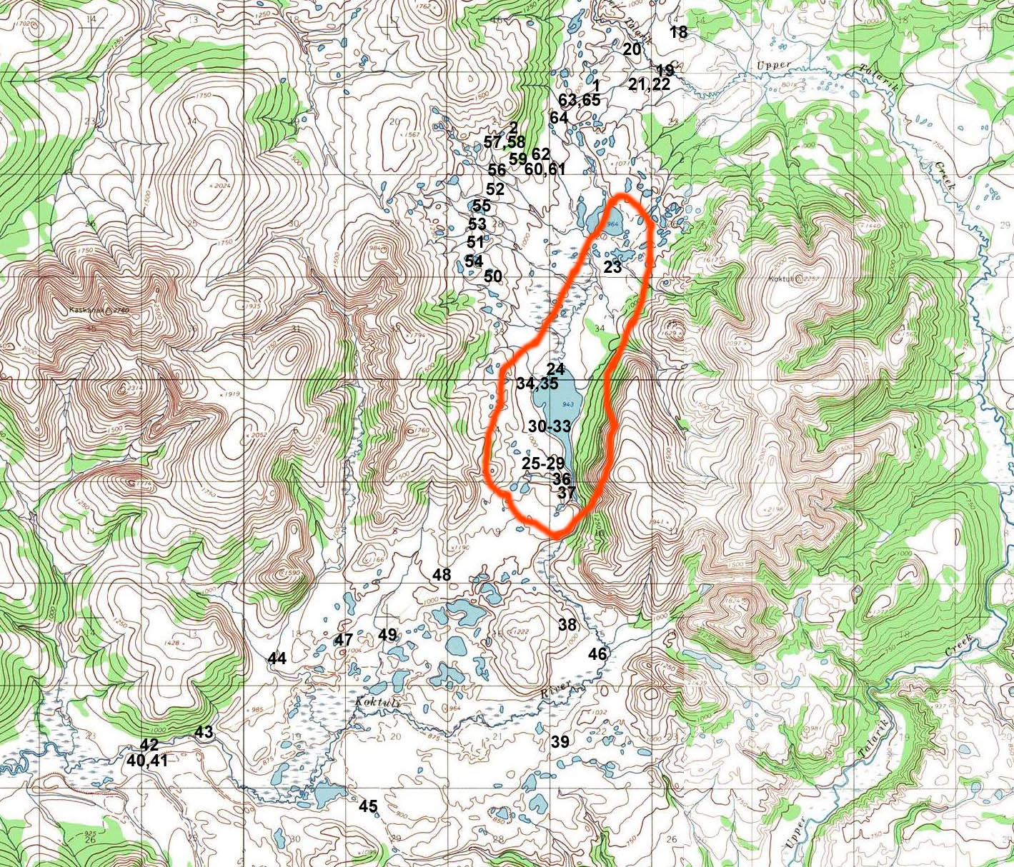
| Pictures taken in the valley of the Koktuli River, in the proposed tailings lake area. Map of photo locations. |
||
|
|
|
|
|
|
|
|
|
|
|
|
|
|
|
|
|
| ||
| Pictures taken at or near the mineral deposit area (proposed mine pit). Map of photo locations. |
||
|
|
|
|
|
|
|
|
|
|
|
|
|
|
|
|
|
|
|
|
|
| ||
|
| ||


|
Read the guestbook | Sign the guestbook All content by Erin McKittrick, copyright 2006-2007. Contact me with comments or questions at mckittre at gmail dot com. Last modified: 2/11/2007 |