|
Pebble Mine Home | 2005 Trek | Photos | 2006 Trek | Facts | News | Links
|
|
Pebble Mine site photos
2005
by Erin McKittrick
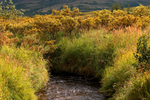
|
|
|
|
|
The Pebble Mine project is a controversial proposal to build a very large open pit gold mine in southwest Alaska, near Lake Iliamna.
The Murkowski administration and the mining industry favor the idea, while many fishermen and local villagers oppose it.
The site sits at the headwaters of two major Bristol Bay drainages (Nushagak and Kvichak), and potentially poses a large threat to the region's
salmon.
|
|
Below is a 75 picture set from my 2005 trip to the Pebble Mine region, with captions, maps, and links to high resolution files. Photos from my 2006 trip will be available here soon (email me if you need them now). Clicking on a photo will link to a 5-10Mb tif file. If you need a particular image, look here. If you'd just like to see some pictures, try the slide show.
I'm working on getting pictures up from my 2006 Trek through the Pebble Mine watersheds. See a brief Photo tour of the mine site and watersheds from this trip, or look at Upper Talarik Creek photos, and Pebble Mine site photos. Photos from the rest of the trip coming soon.
Pictures and other files are provided free for download for non-profit use only. Please credit the photographer (Erin McKittrick). For commercial use, please contact me at mckittre at gmail dot com. My photographs of the Pebble Mine area have been published in Alaska and Fly Fisherman magazines, the Bristol Bay Times, as well as by the Wilderness Society, the Alaska Conservation Foundation, and other environmental groupss.
Powerpoint file with small versions of pictures with captions, and maps.
Word document with a list of picture titles and captions.
Pictures are organized by the area in which they were taken.
|
|
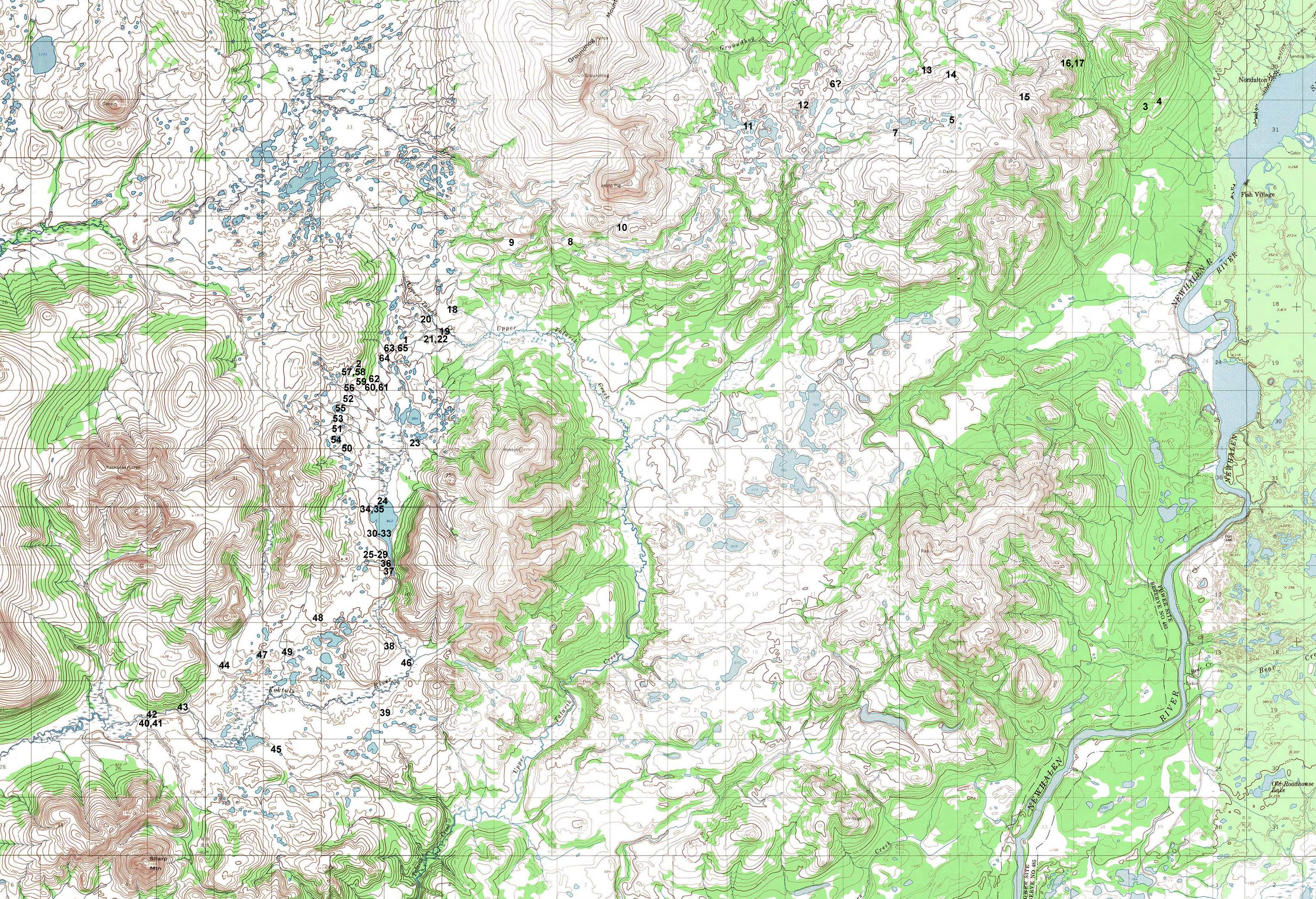
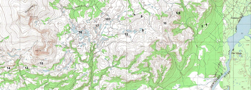
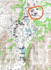
Overview map, intro pictures
|
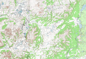
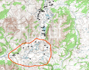
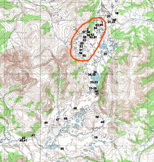
Overview map. Numbers indicate approximate locations of photographs.
|
| 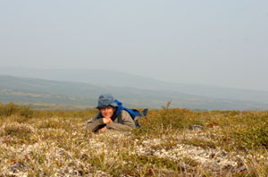
1 - Me in the tundra
Self portrait on a smoky day, on the tundra just southwest of Upper Talarik Creek.
|
2 - Shelter in the smoky hills
My tarp on a smoky morning, at the edge of the mineral deposit.
|
|
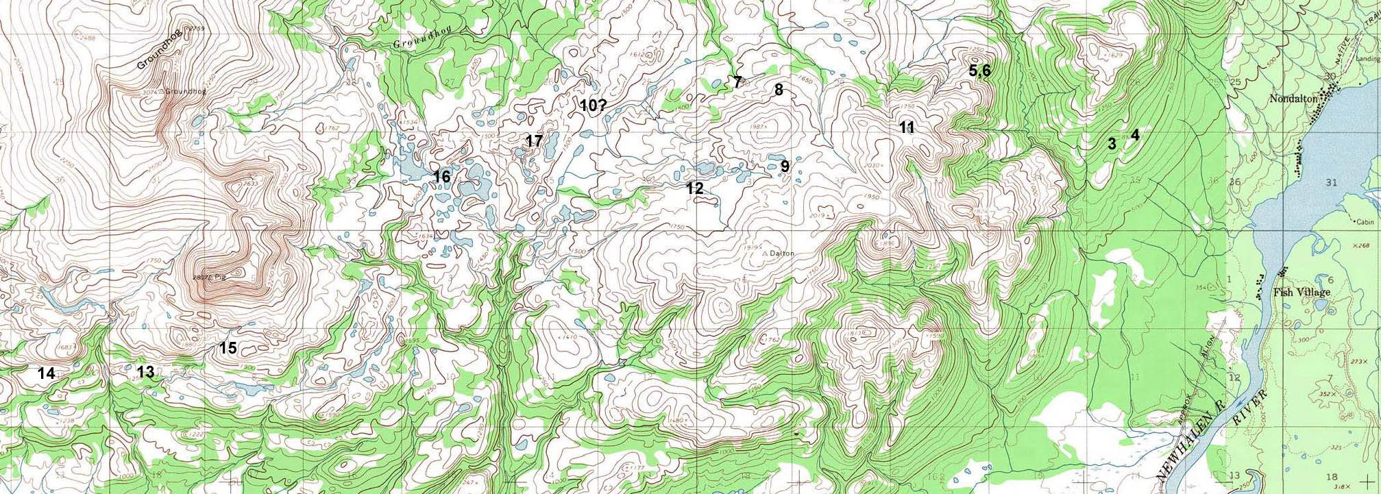
Between Nondalton and the potential mine site
|
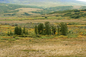
Area between Nondalton and the potential mine site. Numbers indicate approximate locations of photographs.
|
| 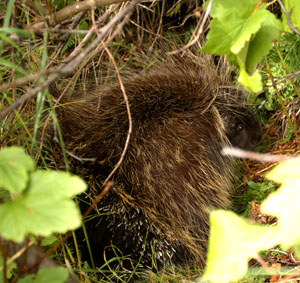
3 - Porcupine in the brush
As I was leaving Nondalton, I startled several porcupines in an alder patch.
|
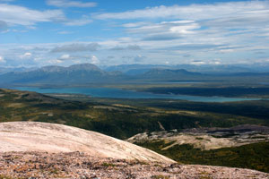
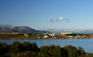
4 - Sixmile Lake and Nondalton
Looking down at Sixmile Lake, the village of Nondalton, and surrounding forests. Nondalton is one of the closest villages to the mine site.
|
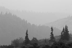
5 - Smoky trees #1
Black spruce line the hills on either side of a small gorge. Hills above Nondalton.
|
| 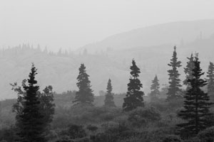
6 - Smoky trees #2
Black spruce seen through a haze of forest fire smoke. Hills above Nondalton.
|
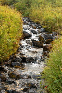
7 - Meadow-flanked creek
Most creeks are in brush-filled gullies, but the few high elevation creeks are flanked by grassy meadows. Hills west of Nondalton.
|

8 - Sour dock
Sour dock lines a small mossy trickle as it flows down from the hills. Hills west of Nondalton.
|
| 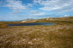
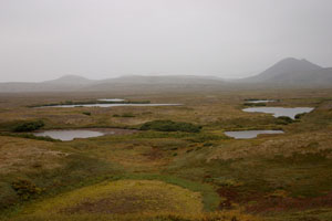
9 - Tundra lake
Small shallow lakes are scattered throughout the tundra, scoured by past glaciers. Tundra plains between Nondalton and Groundhog Mountain.
|
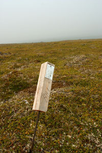
10 - Mining claim stake
Outside the potential area of the Pebble Mine, smaller claim stakes can be found. Tundra plains between Nondalton and Groundhog Mountain.
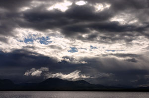
|

11 - Windswept ridge
Only thin patches of vegetation hang on to the rocks at the top of the windswept ridges. Hills west of Nondalton.
|
| 
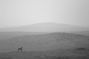
12 - Curious caribou
This caribou snuck up behind me as I was eating lunch on the tundra near Groundhog mountain.
|
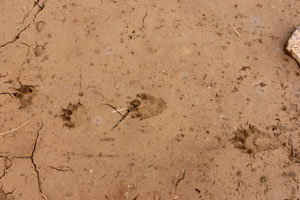
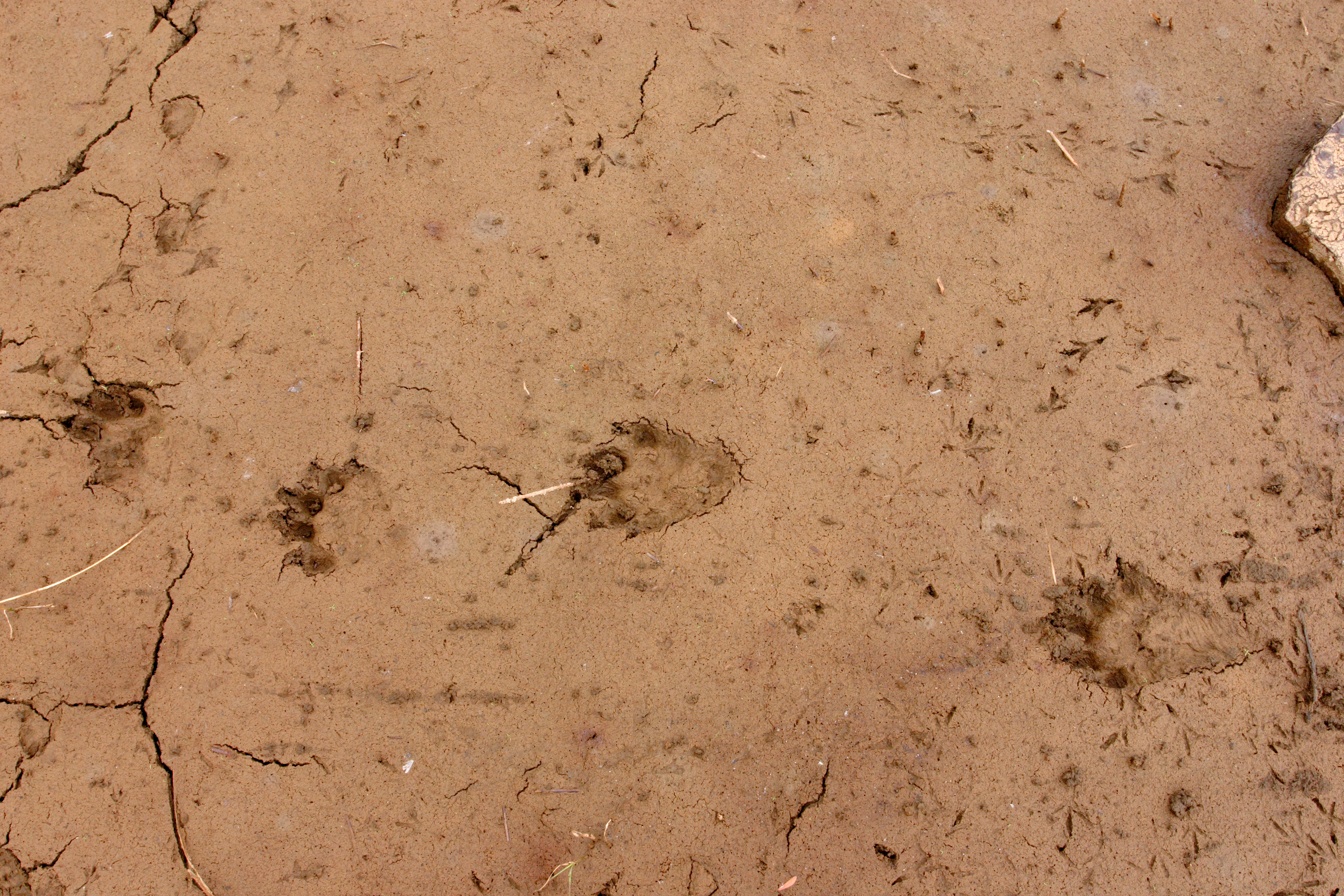
13 - Wolverine tracks
A wolverine, a fox, and many small birds passed through this dried out pond. Hills below Groundhog Mountain.
|
14 - Caribou in the smoke
Finding my way back from the mine area in the smoke haze, I came across this caribou on the south flanks of Groundhog mountain.
|
| 
15 - Beaver pond
A beaver dam and pond, at the foot of Groundhog Mountain. Beaver dams were fairly common in lakes with alder and other brush nearby.
|
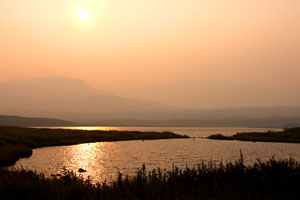
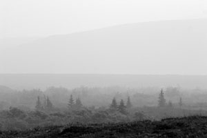
16 - Hazy sunset
The sun sets in a pink haze of forest fire smoke. Looking west towards Groundhog Mountain.
|
| 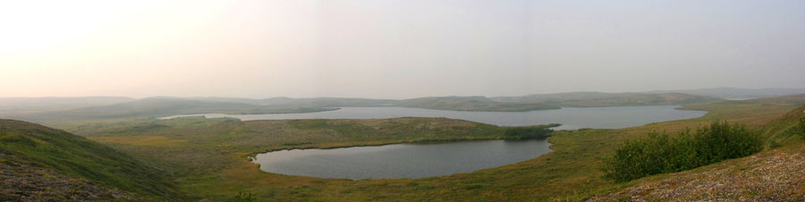
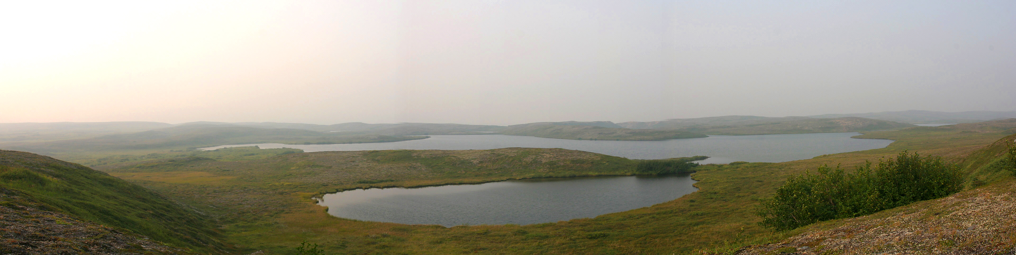
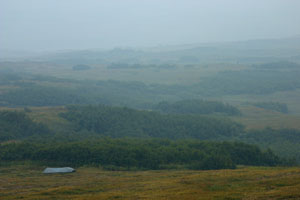
17 - Tundra lakes panorama
A landscape of tundra and lakes. East of Groundhog Mountain.
|
|
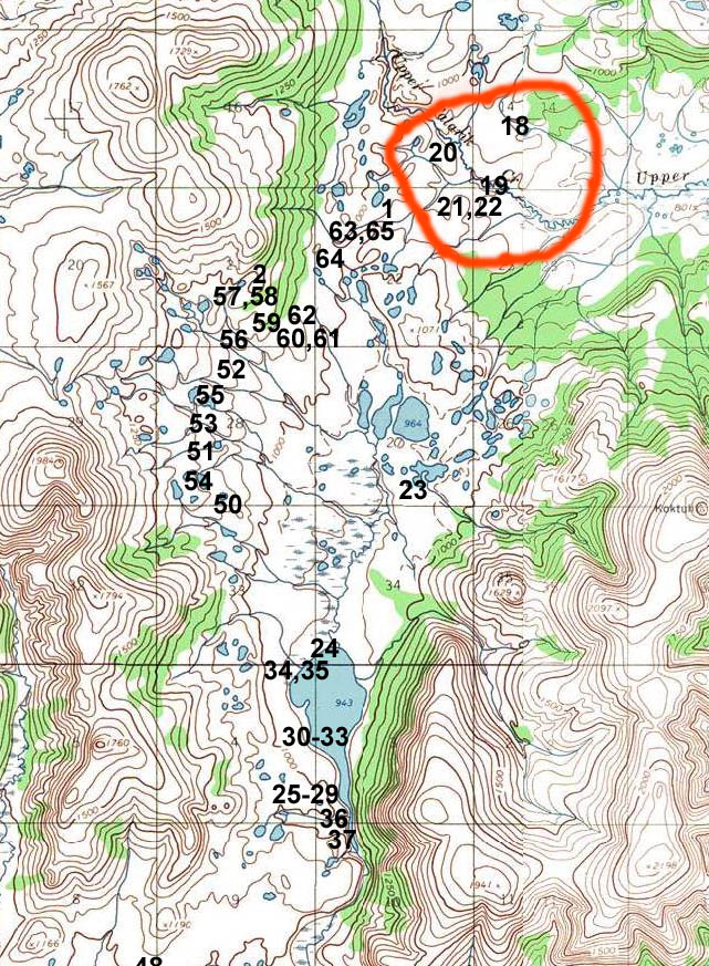
Upper Talarik Creek area
|
| 
Near the headwaters of Upper Talarik Creek. Numbers indicate approximate locations of photographs.
|
| 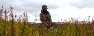
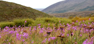
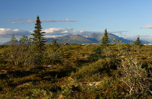
18 - Sitting in the fireweed
Just northeast of Upper Talarik creek, looking out toward the potential mine area.
|
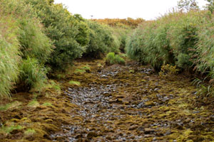
19 - Upper Talarik Creek
Willows and grass line the headwaters of Upper Talarik Creek. Just after I crossed, one of the helicopters buzzed the creek, hovering just a few feet above these willows.
|
20 - Smoky trees 3
Black spruce poke up through a mist of smoke haze from distant forest fires. Upper Talarik Creek.
|
| 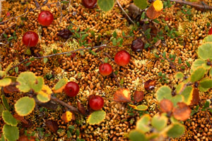
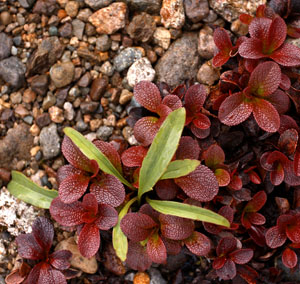
21 - Bog cranberries
Bog cranberries resting on a bed of sphagnum moss, framed by dwarf birch.
South of Upper Talarik creek, near the proposed mine pit.
|
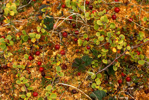
22 - Colorful wetlands
Bog cranberry, dwarf birch, and sphagnum moss create a colorful tapestry on the ground. Near Upper Talarik Creek.
|
|
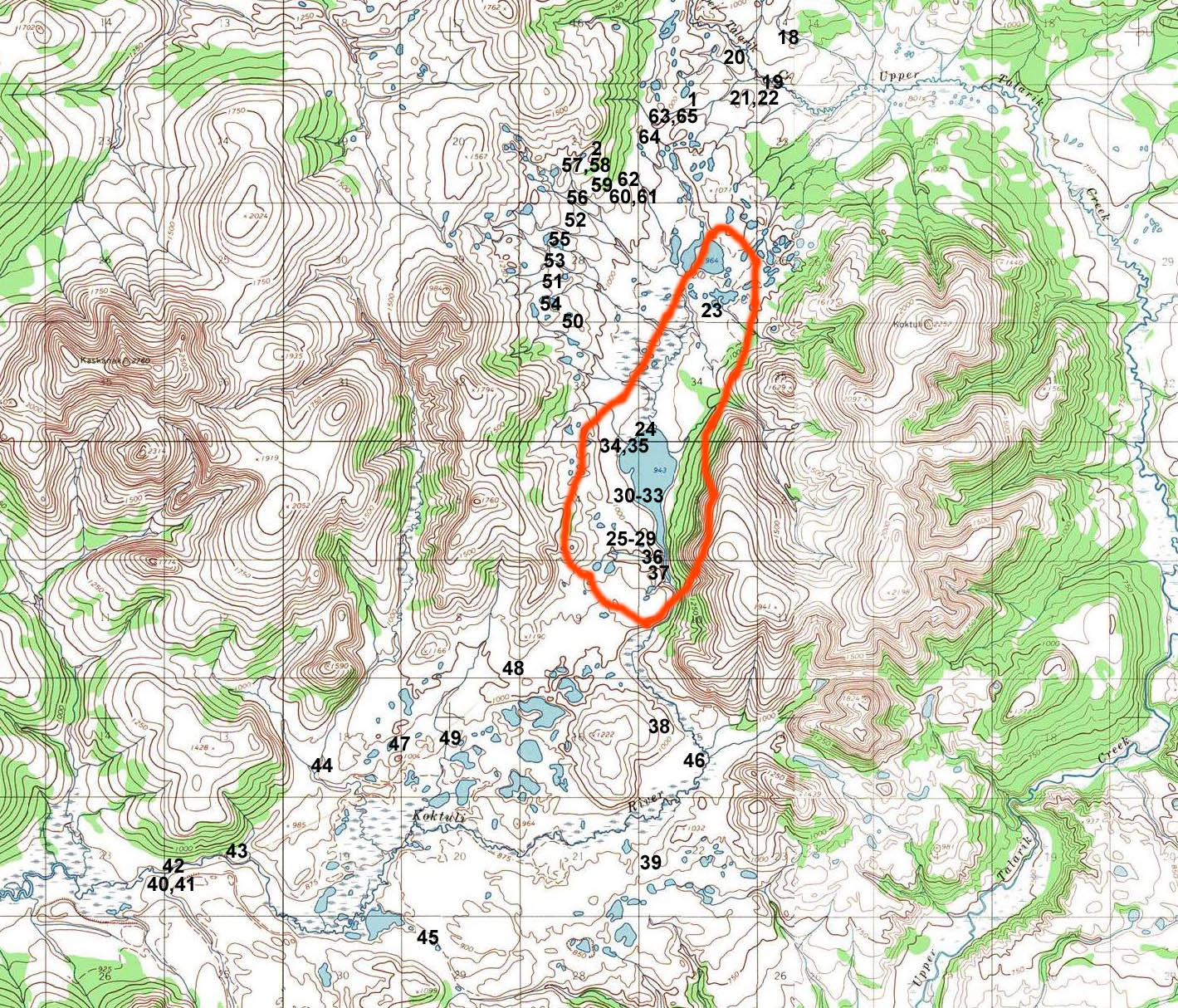
Frying Pan Lake - Tailings lake area
|
| 
Pictures taken near Frying Pan lake (at the upper end of the proposed tailings lake area). Numbers indicate approximate locations of photographs.
|
| 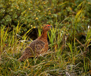
23 - Rock Ptarmigan
This ptarmigan ran ahead of me along the tundra north of Frying Pan lake, trying to blend in.
|
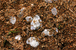
24 - Signs of fish
As I was walking the shore of Frying Pan Lake, I came across a pile of fish scales. Each scale is approximately the size of my pinky fingernail.
|
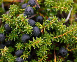
25 - Crowberries (heather)
A heavy crop of crowberries, dotted with water from the morning�s rain.
On a hill above Frying Pan Lake.
|
| 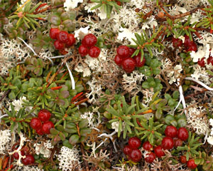
26 - Lingonberries
Clumps of not quite ripe lingonberries are surrounded by reindeer moss, the caribou's favorite food. Hills above Frying Pan Lake.
|
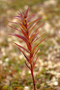
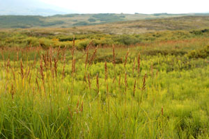
27 - Fall comes to the fireweed
A stalk of fireweed, past blooming, turns red with the fall. Hills above Frying Pan Lake.
|
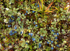
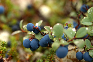
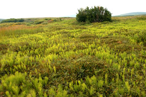
28 - Blueberry tundra
Ripe blueberries coat the tundra throughout much of the mine area. Hills above Frying Pan Lake.
|
| 
29 - Blueberry branch
A luscious crop of blueberries coats the tundra. Hills above Frying Pan Lake.
|
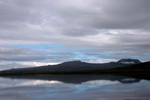
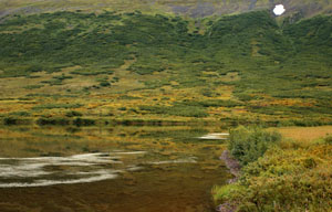
30 - Frying Pan Lake #1
Northern hills reflected in the glassy surface of Frying Pan Lake.
|
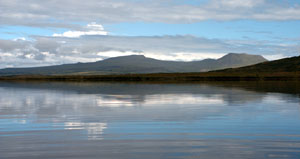
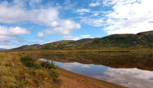
31 - Frying Pan Lake #2
Looking north across Frying Pan Lake.
|
| 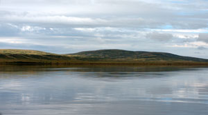
32 - Frying Pan Lake #3
Low hills of tundra and alder, just east of Frying Pan Lake.
|
33 - Frying Pan Lake #4
One last patch of snow hangs on the hillside above Frying Pan Lake.
|
34 - Frying Pan Lake #5
North end of Frying Pan Lake.
|
| 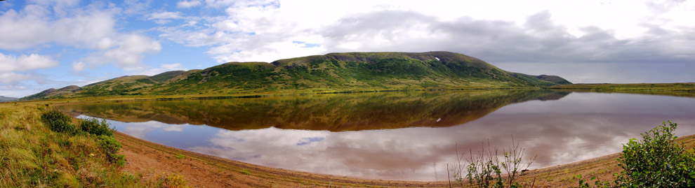
35 - Frying Pan Lake panorama
The reflections on Frying Pan Lake shine in the sun. Looking east across the lake.
|
| 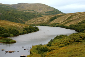
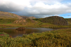
36 - Outlet of Frying Pan Lake
Frying Pan Lake narrows at the southern end, and feeds into the Koktuli River.
|
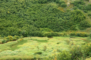
37 - Green world
Alder line the hillside, and grass surrounds a vivid green swamp at a bend of the Koktuli River, just past the outlet of Frying Pan Lake.
|
|
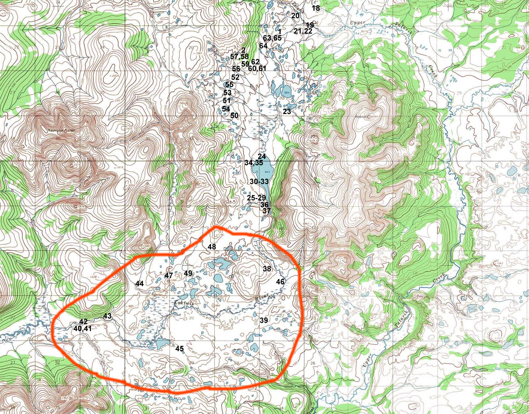
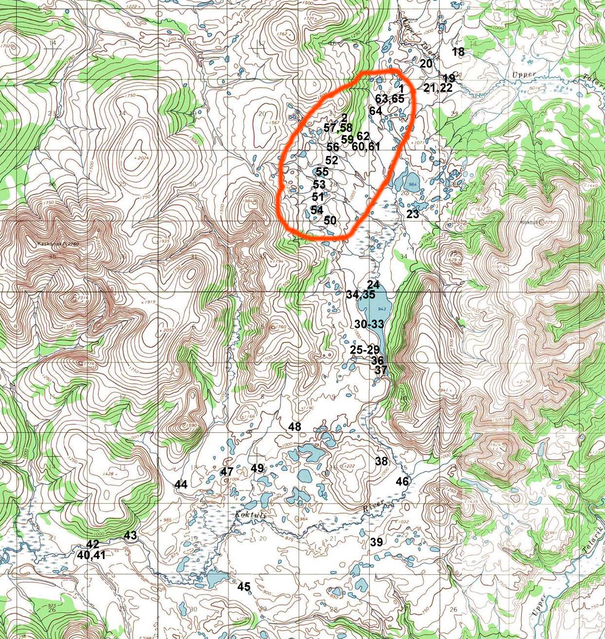
Koktuli River Valley - Tailings lake area
|
| 
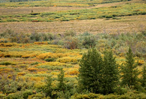
Pictures taken in the valley of the Koktuli River, in the proposed tailings lake area. Numbers indicate approximate locations of photographs.
|
| 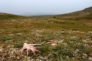
38 - Caribou hills
A caribou antler, weathered pink, lays on a bed of reindeer moss and blueberries.
|
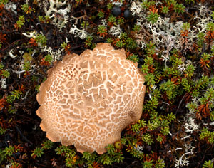
39 - Cracked mushroom
Mushrooms were common on the tundra, mostly bolitas, and were usually cracked on the surface, probably from recent dry weather.
|
40 - Cottonwood stand
A stand of cottonwood rises above the brush and tundra. Tailings lake area.
|
| 
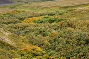
41 - Koktuli River wetlands
Cottonwoods, willows and tundra make a colorful carpet in the flats of the South Fork Koktuli.
|
42 - Dry creekbed
Parts of the Koktuli River can travel underground at dry times of year. Tailings lake area.
|
43 - Texture of the landscape
Smooth tundra flanks line a creek bed bristling with willow and alder. Koktuli River, tailings lake area.
|
| 
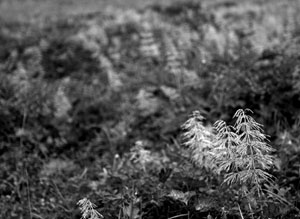
44 - Last of the fireweed blossoms
A field of fireweed lingers in a creek bed. Tailings lake area.
|
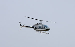
45 - Helicopter
Helicopters zoomed back and forth over the mine site almost constantly. This was one of at least three I saw regularly.
|
46 - Miners' equipment
Small deposits of equipment were scattered across the tundra throughout the site. Tailings lake area.
|
| 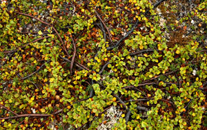
47 - Dwarf birch
A dwarf birch hugs the tundra closely to protect itself from the winds that can scour the valley. Tailings lake area.
|
48 - Bearberry plants
Red bearberry plants hang on to a rough patch of ground. Tailings lake area.
|
49 - Land of glacial ponds
A plain of tundra stretches toward distant hills, dotted with shallow glacier-carved ponds. This is just a tiny corner of the proposed tailings lake site.
|
|
Mineral Deposit Area
|
| 
Pictures taken at or near the mineral deposit area (proposed mine pit). Numbers indicate approximate locations of photographs.
|
| 
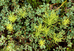
50 - View across grass and horsetail
Looking across a meadow of grass and horsetail, mineral deposit area.
|
51 - Horsetail meadow
A lone alder sits in a meadow of horsetail and mounded tundra. Mineral deposit area.
|
52 - Horsetail and blueberries
Horsetails stick out from a carpet of blueberry plants. Mineral deposit area.
|
| 
53 - Horsetail
Horsetails decorate the tops of tundra mounds. Mineral deposit area.
|
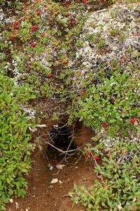
54 - Ground squirrel hole
Ground squirrel holes and trails were common anywhere the ground was dry. Mineral deposit area.
|
55 - Beaver dam
A beaver dam stretches out across a small lake. Mineral deposit area.
|
| 
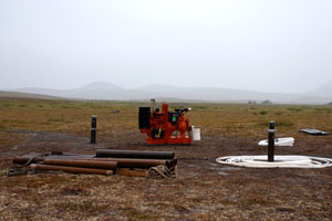
56 - Drilling setup
A constant grinding noise emanated from this camp in the mineral deposit area, adding to the roar of the helicopters.
|
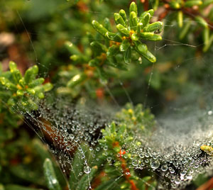
57 - Drops on a web
Fine water droplets coat a spider web strung between sprigs of heather. Mineral deposit area.
|
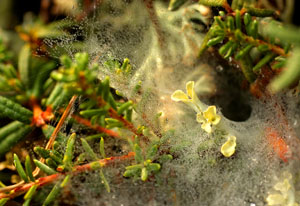
58 - A spider's trap
A tiny spider web hugs the tundra, coated with a fine mist. Mineral deposit area.
|
| 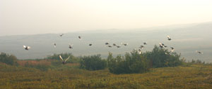
59 - Ptarmigan flight
As I walked down the hill above the mining camp, I startled a large flock of ptarmigan.
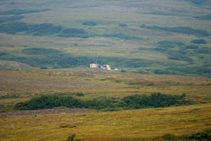
|
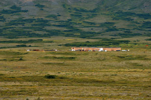
60 - Mining camp
A base camp for mining reconnaissance at the bottom of the hill containing the mineral deposit.
|
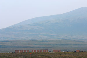
61 - Mining camp #2
Looking at the camp and east across the valley. Helicopters flew in and out of here frequently.
|
| 
62 - Sparkling morning
Sparkling wet leaves of a small bush. Next to the mining camp, mineral deposit area.
|
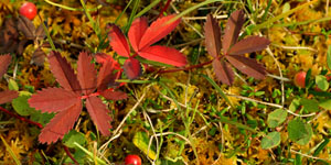
63 - Fall in the wetlands
Red foliage and bog cranberries poke up from a thick mat of sphagnum moss. Flats below the mineral deposit area.
|
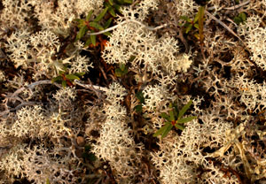
64 - Reindeer moss
This favorite food of the caribou carpets the drier tundra. Flats below mineral deposit area.
|
| 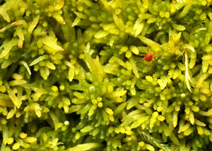
65 - Red mite in green sphagnum
A tiny red mite makes its way across a bed of green sphagnum moss. Flats below the mineral deposit area.
|
|
Nondalton village and surroundings
|
| 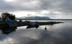
66 - Boats at Nondalton
Boats parked on the shore of Six Mile Lake, at the village of Nondalton.
|
67 - Nondalton Shore
The shoreline of Nondalton village.
|

68 - Six mile lake
Clouds over Six Mile Lake, from near the Nondalton shore.
|
| 
69 - Six mile lake 2
Morning cloud formations over Six Mile Lake.
|
|
Newhalen river, Newhalen town, Iliamna
|
| 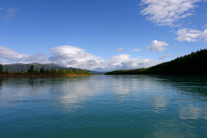
70 - Newhalen river
Looking upstream on the Newhalen River, towards Six Mile Lake and Nondalton.
|
71 - View from Newhalen river
Hills and forest along the banks of the Newhalen river.
|
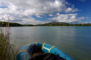
72 - Packraft on Newhalen river shore
My packraft resting on the banks of the Newhalen river.
|
| 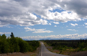
73 - Road to Iliamna
Looking down the long road from Fish Camp (by Six Mile Lake), to Iliamna.
|
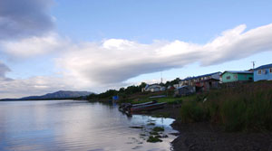
74 - Newhalen across the river
At the mouth of the Newhalen river where it empties into Lake Iliamna, looking across to the village of Newhalen.
|
75 - Tundra near Newhalen
Looking across the tundra by the Newhalen River, with Newhalen's buildings in the distance.
|
|