8/13/04 - day 9 | ||
|
I'm sure I'm jinxing it to say it, but the provisional theme of this trip is that nature loves us. All the weather over our heads is sunny and warm, despite thunder clouds swirling around the peaks. There are no mosquitoes or any insects to be seen. Almost all of the bushwhacking involves bare rock, tundra, or reindeer moss. And the sketchiest rivers have bridges. |
||
|
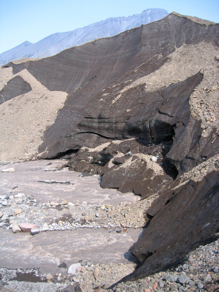
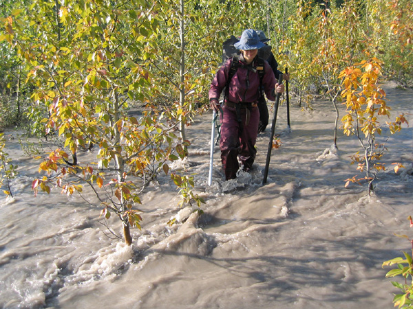
It was the Sanford River that worried us today. Despite the fact that it wasn't marked on our map, we were pretty sure that the Sanford Glacier would have a river coming out of it. And since the Sanford Glacier was larger than any glacier we'd seen so far, we were pretty sure it would be large. We were thinking about that river the whole way up. We speculated whether we could cross the river below Sanford Glacier and again above it, whether we'd need the raft, whether we could even find a place to use the raft, or whether we could cross on Sanford Glacier itself. As we walked upriver, we watched the crossing spots, and it sure didn't look crossable. | 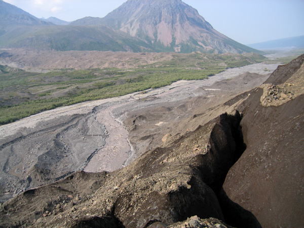 |
|
 |
The smoke has drifted back into our air, and though we were walking closer and closer to Drum, we viewed it through a bluish haze. It was easy walking on the river flats, but we'd slept late and acted lazy. We stopped at one point at a tiny clear water stream where Hig caught a little Dolly Varden by hand. But Hig and David couldn't get any more there that way, so we ended up half-cooking one little fish on a tiny little stream before moving on. We wanted to get to the Sanford River, our real potential stumbling block, before taking any longer breaks. |
|
|
The Sanford River had been bridged for us. Sanford Glacier was a mass of dirty mounds. It was built of disorderly ice peaks draped in gravel, like every other glacier we've seen around here. And some of these gravelly mounds lay right across our river. We clambered over the moraines, and watched the river shoot out of the ice far below us. Nature loves us. |
 |
|
 |
After that we did take a longer break, filling ourselves with a nice hot meal and napping in the shade, before undertaking our last big climb of the trip. Up the gully and to the pass. |
 |
 |
 |
 |
|
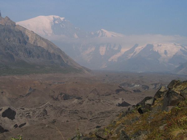
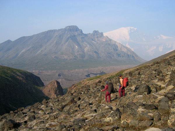
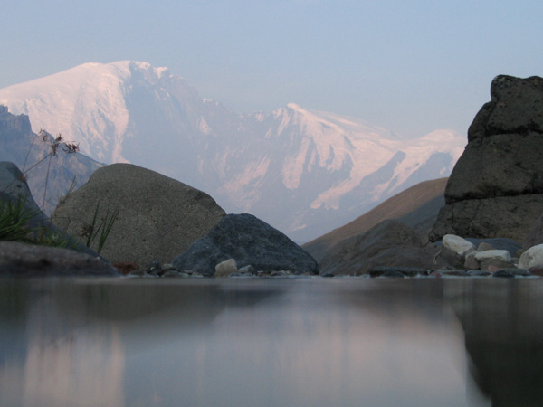
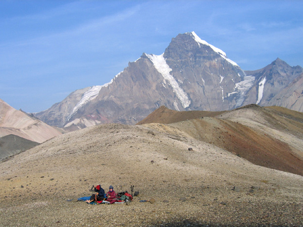
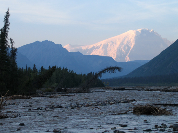
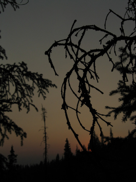
We're camped at the pass between the Sanford River drainage and the Dadina River drainage. We're between our skirting of the mountains and coming down out of them. And we're between Sanford, Wrangell, and Drum. We can see all three from this pass, and I can't wait until the light is better in the morning. Drum is so close that it's nearest ridge seems higher than it's peak, jutting up in imposing, spiky, and technical heights. Back down the valley we can see yet another side of Sanford, with its 5000 foot face of rock flanked by snowy ridges. And just over the pass, Wrangell pokes out again, stately in its low and smooth white slopes. We can hear the rockslides from our bed, as the giants slowly come apart. |
||
8/14/04 - day 10 | ||
 |
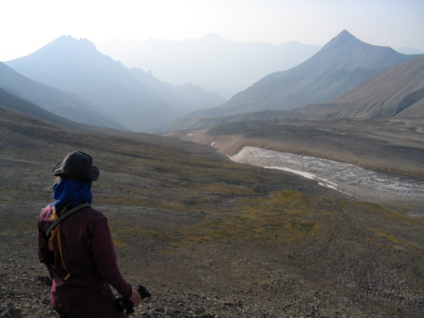
We woke up this morning to a rushing wind in the pass, whipping the shelter around with a thwack thwack sound. We flipped off the roof, and there was Drum, spiky and towering, almost right on top of us. Sanford and Wrangell were cloaked in a smoky haze, further away and barely visible. It was my turn to lead today, and I led us down the gully. Right from our pass down the gully, to the Dadina River, and downstream. It was not very navigationally complex. |
 |
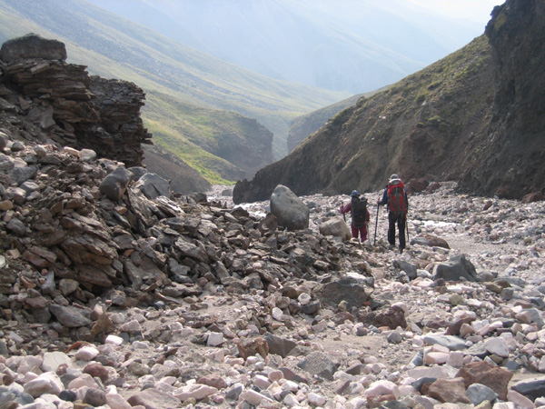 |
The gully started with piles of angular loose rock, which gradually transitioned into smoother rounder walking. Crumbly cliffs rose on either side of us, but the gully bottom was always wide enough to walk on one side of the stream or another. Getting back and forth across it was another issue altogether. It was a small stream, but I wanted to keep my feet dry, so I fell in twice trying to hop across it - ending up bruised and wetter than if I'd waded, and proving my general incompetence at jumping. |
|
|
There were no fishable pools where our gully joined the Dadina River, but we cooked up our corn chowder anyway and rested in the shade. And we talked to more sheep hunters (or David did, anyway). Those guys are everywhere. These ones were camped almost where we were taking our lunch break, and they were responsible for the tracks we'd seen coming down the gully. They were telling us how the Dadina had changed course drastically in its braid plain overnight. |
 |
|
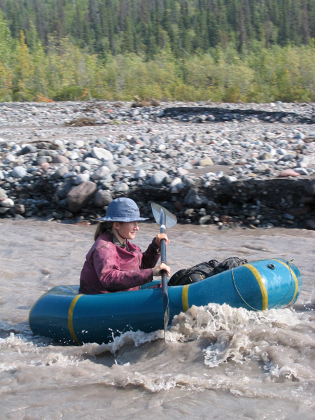 |
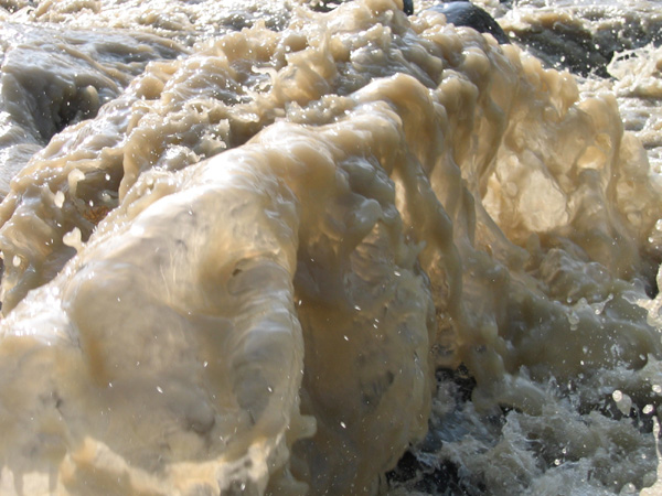
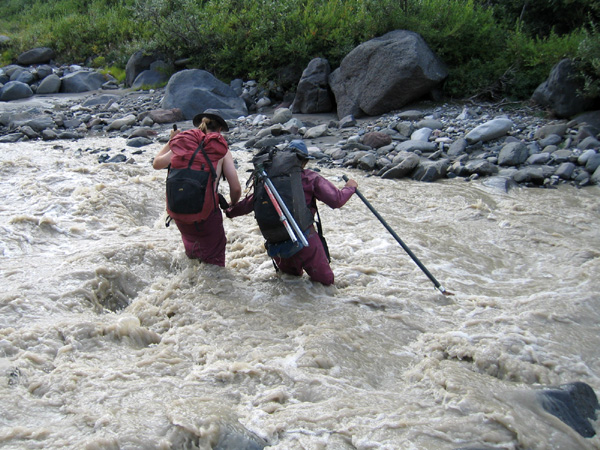
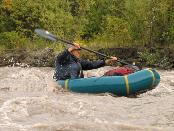
The Dadina is glacial, so it's in high flood now, but it is otherwise a small braided river. And today we learned our lesson about flooding on small rivers. The river emphatically drove the lesson home as it hammered us at high speed into gravel bar after gravel bar. We'd been hoping to raft the Dadina, so we were a bit too eager to hop in at the first large enough looking channel. But adding a lot more water to a too-small river does not necessarily make it more raftable. We got nailed by the gravel bars. The river was too fast and too shallow. I could barely read ahead of where I was, and even if I could, I couldn't always get to where I wanted to be. And I crashed into gravel bars some more. It wasn't so dangerous for us, but it was a sucky way to travel, and really hard on the rafts. Hig is trying to patch a couple of holes in the bottom plate of his raft overnight. We had a long discussion/argument about what to do, then ended up rafting another short ways and then packing up to walk. It was maybe 2 miles of rafting in total, and the river doesn't look any better for rafting here than where we started. | |
|
Unfortunately the bushwhacking has also gotten worse following the river. There have been some great sections of trail though, which we'll hopefully pick up again tomorrow. We walked through some weird water today. Where we came back down the bank from our first animal trail, the ground was gone. The forest was there, green and growing, the soapberry shrubs were happy, and even the tiny lupines and reindeer moss looked ok. Except for the silty water rushing over and around them, taking back the forest. The water was over knee deep among the cottonwood, and we followed the flooded forest back to the dry gravel plains. It must be a very recent river change, and now that the river's dropped this evening, it may even be dry again. The other weird water was streaming out across the forest floor, through trails and woods and stands of willow. We waded through the thick willow in calf-deep water, and then splashed down a flowing trail, gatherign algae around our ankles as we walked. |
 |
|
 |
So nature has grown a little less kindly, with the rivers, the bushwhacking, and even a few bugs. We'll see what comes of tomorrow. I'm hoping for fish. |
|
8/15/04 - day 11 | ||
We're camped on a slight ridge in the middle of the spruce forest. There's one small spruce tree in the shelter with us, and stretching away in every direction is mostly flat spruce forest with an under story of dwarf birch. And all of this is in the middle of somewhere. We don't know exactly where. We're fairly sketchy on approximately where, to tell the truth, but I do have a couple of good hypotheses. |
 |
|
|
For most of today I had the relatively easy job of leading us downstream along the Dadina River. We got a late start, as David and Hig woke up early to go fishing, while I slept in. We had a stew of small Dollys again, with sour dock and bolitas mushrooms. We picked a bunch of blueberries to finish off the meal, and even found a handful of ripe nagoonberries. The nagoonberries were certainly the highlight of the bushwhacking along the river. Willow abounded, even in the spruce forest, and we had to make on very large and swampy detour inland around a system of beaver ponds. But by the river, we saw a wolf. |
||
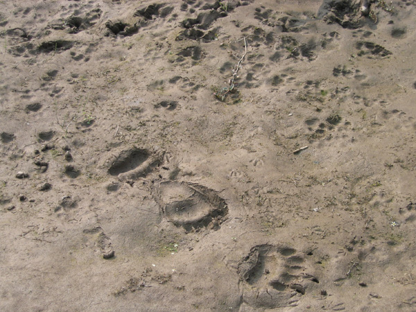 |
We've noticed there is a lot more animal sign along the Dadina than anywhere we've been before on this trip. On the mud banks we saw moose tracks, fresh bear tracks, and the tracks of a whole pack of wolves. Hig and David had even heard them howling this morning. But I didn't expect to see any. You never see wolves. For all the tracks I've ever seen, I've only seen one wolf - far across a snowy valley and barely close enough to eliminate other possible things it might have been. |
|
|
These guys were unmistakably wolves. David saw them first, a ways ahead down an abandoned river channel we were following. They were hanging out there and could have easily left long before we saw them. Instead they stood there, looking at us, coolly confident of their place in the food chain. And then they silently melted away into the trees. It made my morning to see them. |
||
 |
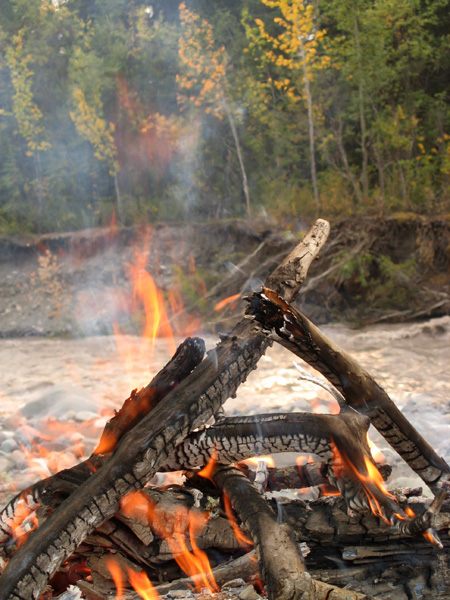
The Dadina River slowly narrows as it travels downstream, then enters a single-channel gorge. All of this meant that as we followed it down we went from wide shallow braids into raftable country. This time the raft inflation was a more successful venture than it was yesterday. We put in and we cruised. The river was fast, steep, and getting steeper. We didn't mind the wetness on such a hot day, but the going was pretty exciting. Eventually things were big enough and I had run out my capacity to enjoy rapids for the time being. Our gravel bar siesta let us dry off ourselves and our gear by the fire, take naps, and watch the weirdly colored sun through the smoke and clouds. |
 |
 |
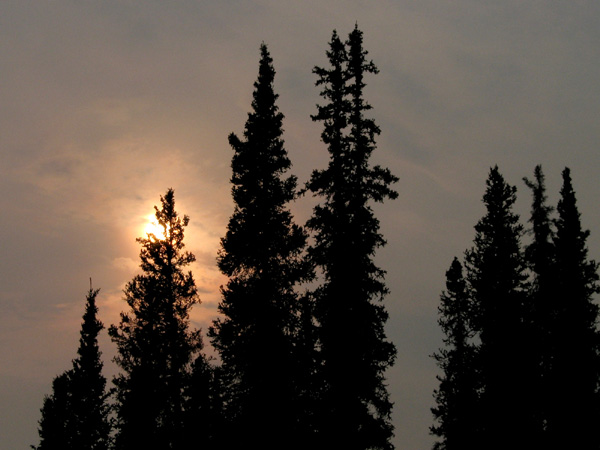
There was a lot of smoke in the air today. I could feel it in my nose and eyes, and even lines of trees on the far riverbank were layered blue with depth in the thick air. We discussed the possibility that we might even run into this forest fire, wherever it is, though it seems unlikely. If we did run into one, it'd be good to head for a largish lake or gravel plain, so we promptly lost our way from either. |
|
|
We were headed off the Dadina River to Dadina Lake. Dadina Lake is only a mile or two away from the river, and it's at least two miles long. So you wouldn't imagine I could have gotten us so confused. It all started with an animal trail, cutting away from the river. It was a huge trail, so we followed it for awhile, then decided it really wasn't going our direction. But at that point, we were high enough above the river that it seemed to make the most sense to just cut in to a smaller lake, or to hit the stream between it and Dadina Lake. So I veered left for this purpose, and immediately lost the guiding influence of the sun, as it vanished into the smoke. |
 |
|
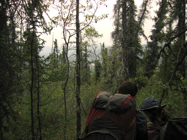 |
Hig and David thought I was going too far left, so I veered right (not checking the compass). Of course, we hit the Dadina again. Oops. Not that we knew where on the Dadina we were, of course. So we took the compass bearing that seemed most likely not to miss the lake. But then it seemed like we should have hit it already, and the terrain didn't quite seem right. So we zigzagged on our compass bearings, going magnetic south, then west, then magnetic south again. And then it got dark. So I am left with tomorrow to see if any of my hypotheses are right, and to try and get us out of this mess we are in. When topography goes away and all vegetation looks the same, it is easy to see how a person could get truly lost. |
|
8/16/04 - day 12 | |||
|
We did find Dadina Lake. Hig climbed a tree, so he knew there was some sort of lake in the low spot. Reassured by that prospect, I set off that direction on a southwest compass bearing. And we hit a lake. Which was actually Dadina Lake, rather than some unknown lake off the edge of our detail map. So we promptly failed to find fish in it. | |||
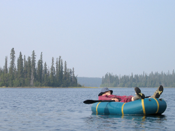 |
We took a long break, floating across the hot sunny lake on our rafts, fishing and napping. There was no sign of a cabin where it was marked on the map, but there was one at the other end of the lake, and there was both new and old sign of people on a beach in the middle. Someone had carved 19HB50 into a rock at the water's edge. We gathered some pond lily seeds to make up for the lack of fish, and headed for the outlet of the lake. |
 |
|
 |
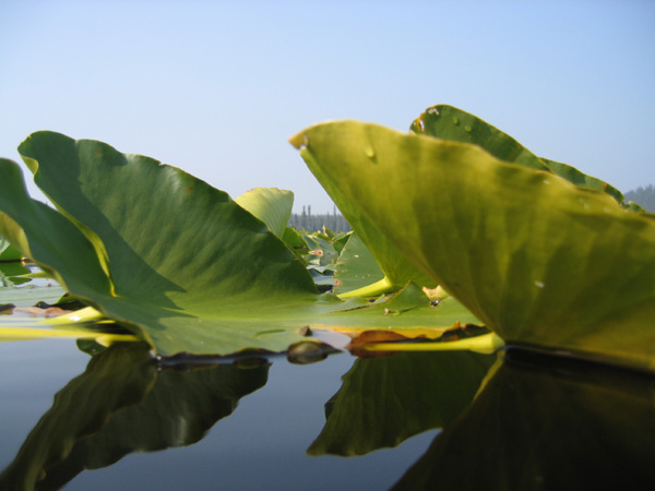 |
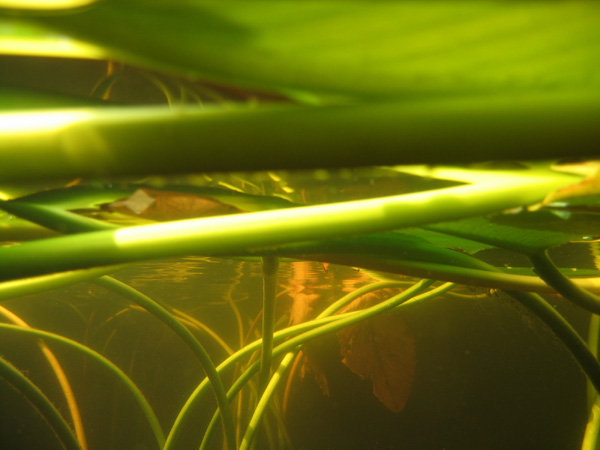
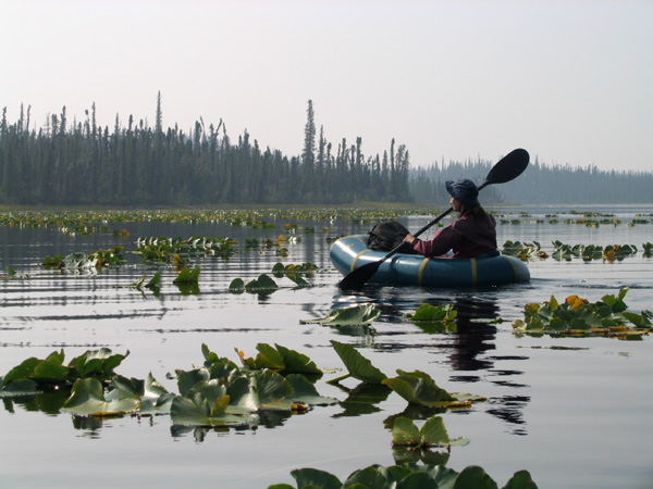
We wove through picturesque clumps of lily pads, taking photos, and ended up at a shore with no trace of an outlet. There was no trace of an inlet for Dadina Lake either, and I suspect whatever USGS guy made these maps just enjoyed inventing his own streams. |
|
|
We ambled down the nonexistent stream to the next lake, still on a compass bearing through the confusing terrain. This lake was smaller and ringed by a fringe of crunchy dry swamp moss, under the full glare of the way-too-hot sun. As we vegged out in the shade of the spruce forest, counting our calories of remaining food, we discussed how to make it take longer to get to Chitina. It was a good day for laziness, being really damn hot without much of a breeze to show for it. Our third potential rest point was the stream we're following down to the Copper River. But the gully was bone dry, with a decidedly mossy floor in places, suggesting it's not often wet even in a wetter year. | |||
|
We're camped where that dry gully cuts down into a gorge, almost out of water, in a cloud of no seeums, a few miles up from the Copper. Luckily our mosquito netting keeps out most of the little buggers, and I'm looking forward to seeing the big river tomorrow. |
 |
||