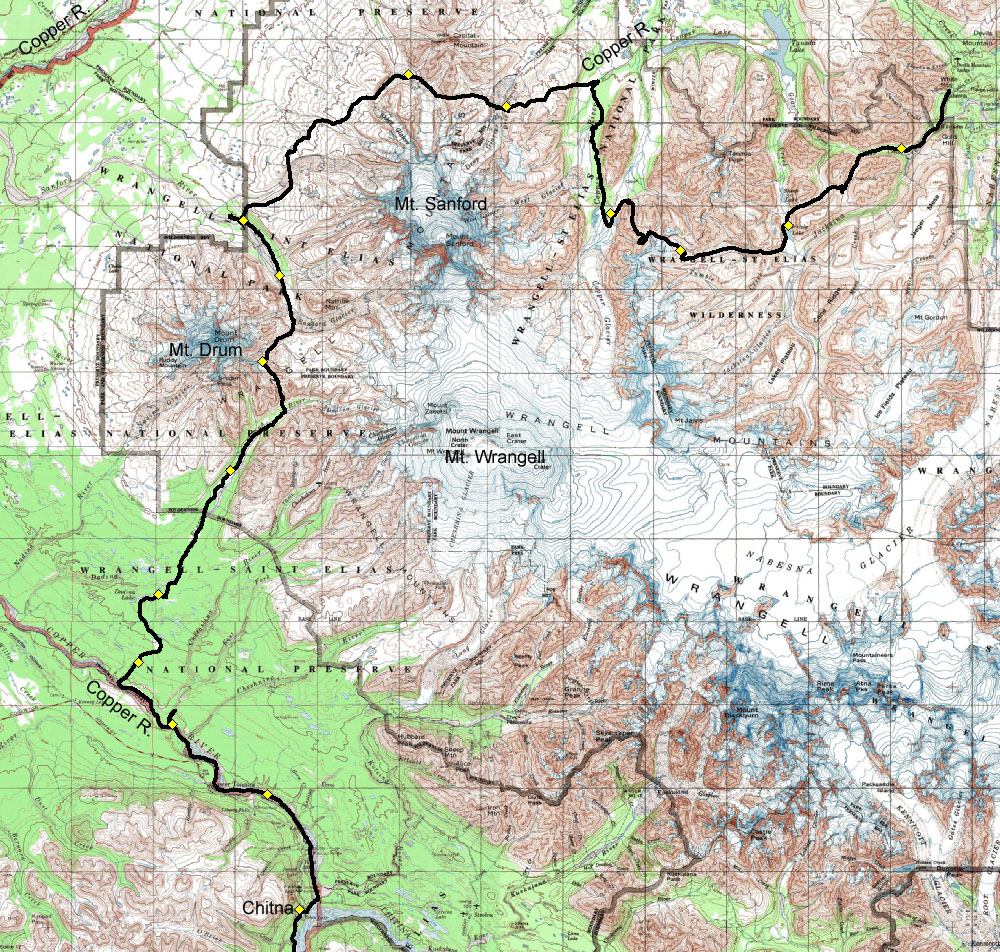
After recovering from the Wilderness Classic, we met up with our friend David, and set out for the Wrangell mountains. David's relatives kindly drove us out to Nabesna, and we walked from there to Chitna. The basic goal of this trip was to get very close to the massive peaks of the Wrangells (Wrangell, Sanford, and Drum). Our views were dominated by the great volcanoes and cloaked in a haze of smoke from Alaska's raging forest fires. It was hot and sunny, in keeping with the bizarre weather of the summer. Every clear water stream was dry, and every glacial creek was flooded. Everything that should be wet was dry, and I have dubbed 2004 "the year of the crunchy swamp." Much to David's dismay, we had no good bear sightings on this trip, but did see a couple of wolves. We finished the trek by dropping down to the Copper River, and pack rafting down to Chitina.
8/5/04 - day 1 |
| A heavy start |
 |
This summer, I have done more riding in cars across Alaska than I ever have before. I've been on the Anchorage-Homer run four times already, and today we drove another 6 hours from Anchorage to Nabesna. We were lucky enough to catch a ride with David's Anchorage relatives, who kindly dropped us off.
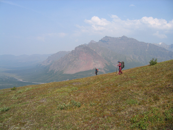
And we were off and lumbering under the hot sun, bearing heavy packs. On this trip, I'm happy to not be racing, but I do miss carrying that racing weight pack. There is no getting around the fact that 12 days of food is heavy.
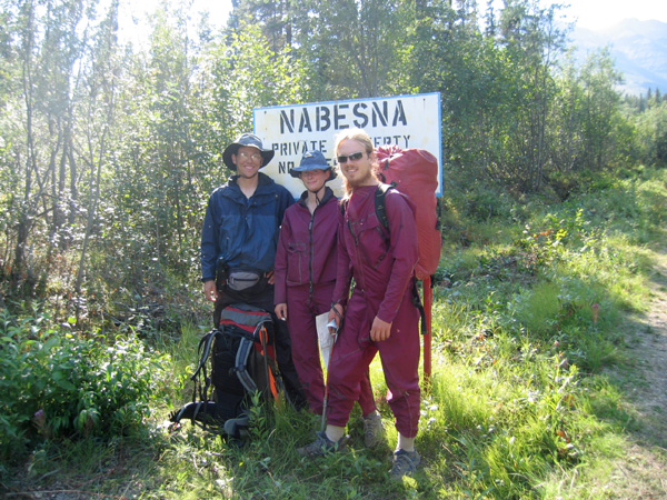
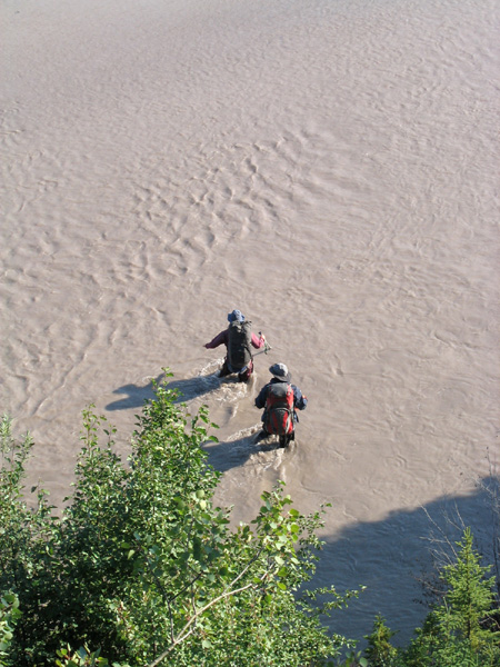
The highway wound us through flat dry forests of black spruce, across swollen glacial rivers and dried up clearwater streams. We watched the triumvirate of Drum, Wrangell and Sanford approaching. Three massive volcanoes, all over 14,000 feet, towering in a crowd of rock and white. We saw the steep precipice of Sanford, the rounded cone of Drum, and the long wide shield of Wrangell itself. We have left them for now, but we're headed right in between them later.
|
|
We've gone 6 or 7 miles up the little Jacksina this afternoon and evening. And by Hig's estimate, this 12-day trip will take us 8.5 days. Oops. Actually, what we've seen so far is that the traveling is a whole lot easier than we thought it might be.
We feared the map green lowlands would be thick and difficult, but most of what we've seen is trails and tundra, moss under living black spruce, and alder growing straight up down.
|
 |
 |
The trail's an old trap line and animal trail. We found a trap hanging on a tree, still with fox bits in it, and a cabin that had been used (but maybe not for trapping) as recently as a few years ago. It was well built and well-enough bear-proofed but the squirrels had gotten in there to nest.
There's not much animal sign in this valley, which is probably good, since the sklup bags have leaked on my thermarest and pack, and everything I own smells of peanut butter. Only a few mosquitoes, luckily, are getting in under our netting. |
|
8/6/04 - day 2 |
| And the water is gone |
|
We took it easy today. The heat was relentless, the packs are still heavy, and my joints and feet are still a little funky from their prior abuse on the wilderness classic. But it didn't matter. We made it easily to our dot on the map, crunching over bone dry tundra and cruising up long low-angle passes. |
 |
 |
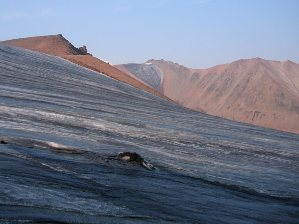
It looks like there hasn't been rain here in a month. The small alpine lakes have shrunk down to small ponds with wide muddy beaches, and most streams were only intermittently flowing. The only snow we've seen is towering above us on 13,000 foot peaks.
|
|
We're in dry Alaska now, and the vegetation is closer to the Brooks Range and the Talkeetnas than to the wetter Kenai Peninsula. There is almost no brush here, but we have found tussocks. They were the bane of our existence in the Brooks Range, and I dread an encounter with worse tussocks. So far we've managed to skirt the worst of them. |
 |
 |
 |
 |
|
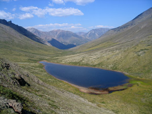
We're camping just above Grizzly Lake, where David managed only to find tiny little fish, and didn't catch anything. At our siesta break on a small and shrinking alpine lake, there was no better luck. I wonder what will have fish up here?
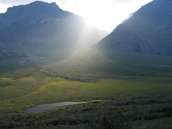
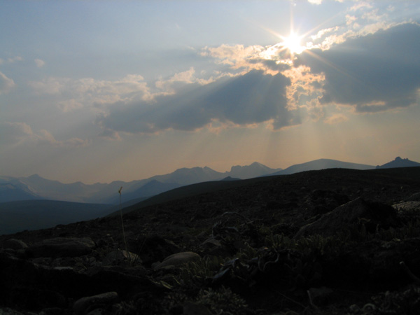
The view from the pass before we dropped down into Grizzly Lake was amazing. A snow-capped volcano rose over smooth ridges and plateaus, god rays streaked down in front of them, and the pass below the fan of gravel shimmered in the glow. It's such a spectacular view that I'm not really surprised that the helicopters bring people to look at it. There was a muddle of people tracks by the little lake at the pass. New and old, the tracks showed a medley of tourists stomping around in their great variety of shoes.
|
 |
 |
|
With that we've seen almost more people sign than animal sign on this trip. We've still not had a glimpse of anything larger than a ground squirrel, the reindeer moss has gone uneaten and untrodden by caribou, and prints have been few and far between.
|
|
8/7/04 - day 3 |
| Hunters |
 |
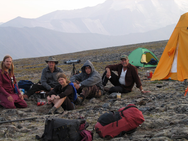
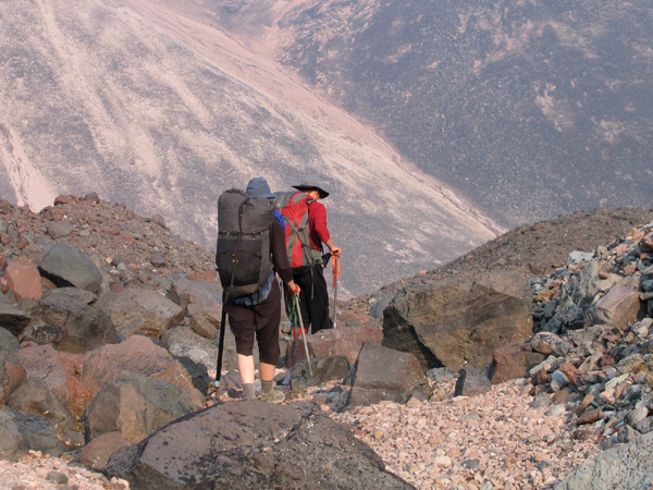
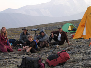
It's only the second time we've ever run into people in the wilderness, and really this is the first time it counts. On the Wilderness Classic, we knew there were a bunch of other nutcases running around off the trails in the Talkeetna mountains. Here, we had no reason to expect any people in the middle of the wilderness. So when David and I spotted the orange tent ahead of us on the ridge we immediately tried to pass it off as a rock. But it persisted in being bright orange and tent shaped as we approached. And finally several people came down the ridge and appeared by their bright orange tent.
|
|
We halted our approach to put some clothes on. For the first time ever, we were all hiking completely in the nude. It's not often in Alaska that you get proper conditions for nude hiking. First off it has to be warm enough, but not under direct sun, since sunburns are bad, and there can't be any scratchy brush or an excessive number of mosquitoes. So basically, it hadn't ever happened until the day the hunters watched us through their high-powered spotting scope.
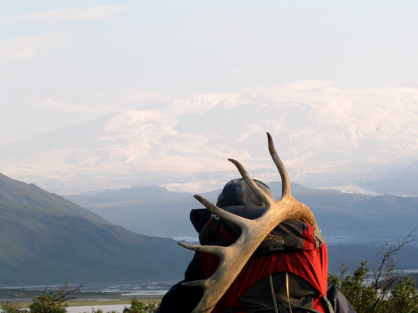
"It's hot today, huh?", one of them remarked with a smile as we approached their camp. They said they'd seen us coming along the ridge So between seeing the naked hikers on the ridge in the middle of nowhere, and having them show up in camp in bizarre fleece suits and homemade burgundy raingear, wearing their hair in pigtails and talking about how they're walking to Chitina, I think those hunters will have a pretty amusing story to tell when they get home. They were hunting sheep, and the first sheep (actually the first large mammals of any kind) we've seen were behind us on the ridge and pointed out by the hunters. |
 |
 |
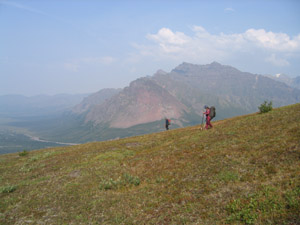
We made great time on that ridge. Our lack of clothing kept us cool, under our feet was crunchy reindeer moss with just the right amount of squish to it, and it took us on a low angle climb all the way up to the glacial peaks. The smoke haze obscured anything at much of a distance, but added such a depth to the layers of mountains that everything looked a little more dramatic, a little grander, and a little farther away. We couldn't see any of the three big peaks, but the 13,000 foot Mt. Jarvis towered over us well enough with its cloak of ice. |
|
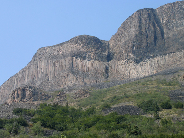
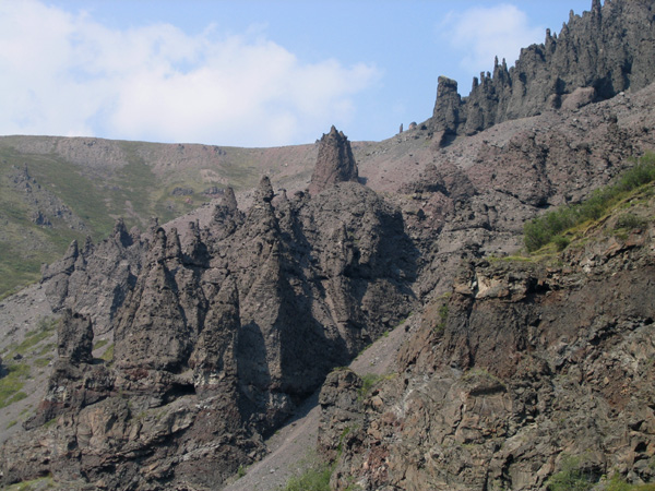
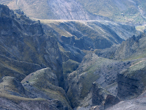
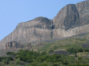
We only walked for about 4 or 5 hours on the ridge, but mad most of our distance following its curves. It was a lazy morning. We figured we had time, so we didn't even start walking until 11. It was hot, and we had time and a hunger for fish, so we stopped on the other side of Grizzly Lake to fish. No luck. Our heat, thirst, desire for fish, and general pokiness made the first four miles of the day take over four hours. And it wasn't very difficult walking. Following the stream valley we passed under slopes of columnar basalt, cliffs with caves and arches, and hillsides dotted with bizarre spires of rock, clustered together and eroded from the mountainside.
|  |
 |
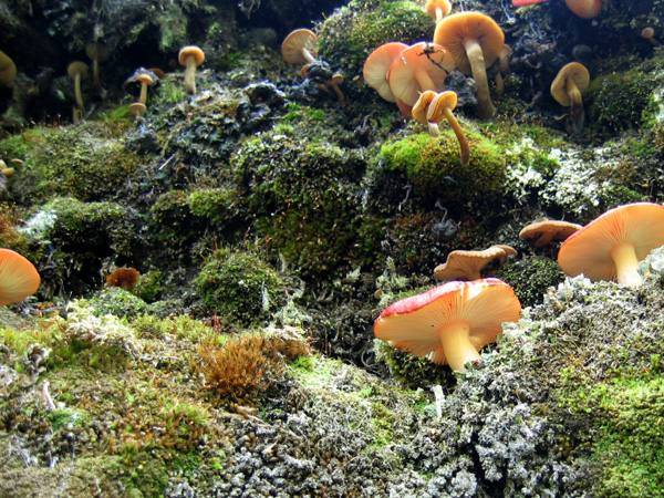
We've still not caught a fish, though it's not for lack of trying. We found one big grayling in a pool just below the ridge, but further pools on that stream were sadly empty. He was too wily for us. Maybe next time. If we ever do catch a fish on this trip, it will taste all the better for our failures. And while David was trying to fish I did gather some nice blueberries, which greatly improved the lemony cookie crumbs. I think gathering is the better deal of this whole hunting/fishing and gathering gig.
|
|
8/8/04 - day 4 |
| Detour |
|
Today I learned that I ought to actually look at the map before agreeing to any proposed route change, and Hig learned that you really need to look at every single pair of topo lines before heading down a steep gully. David learned to fill up on water more frequently when we have the chance. | |
 |
We skirted a glacier in the pass this morning, thankful that we hadn't chosen to camp there on the steep unstable moraine. And then we headed down into a field of ice-cored moraines, topped with gravel, boulders, and mud. Sheep wandered around on the completely unvegetated slopes, scattering almost as soon as we got close enough to see them. I wondered what they ate in this realm of gravel, and how the hunters could possibly get near enough to shoot. |
Then we climbed over the pass and started in on our mistake. The map makers hadn't marked the topography in the bowl, but that wasn't our problem. Our problem was that we decided to go down the gully. Up is hard, traversing sucks, and down is complicated. And this is where Hig and I learned our respective lessons. So we shot down into the gully and started a scrambling descent, which got trickier and trickier as we cut further into the bedrock. We scrambled down a few small drops, tossing ice axes and paddle shafts ahead of us, before we hit the real cliffs. The real cliffs were in the one contour interval Hig didn't look at closely enough, and it doesn't take much of a cliff to stop a few people with no rope. |
 |
 |
 |
We climbed. We cut up the slope, 1300 or 1400 feet in the hot sun, scrabbling over slidy scree back up to our ridge. It was hard, and it was depressing. And where there wasn't scree, there were piles of very unstable boulders waiting to topple underfoot. And there were more of these on the ridge itself. We arrived at the top of our climb to look back a few hundred yards to the point we'd cut down to the gully.
It was a sad sight, but at least the gully had been pretty. Aside from the boulder piles, the ridge was pretty nice up to the end. And aside from the blisters. My little toes strongly objected to the entire idea of walking until I wrapped half my foot in gauze and medical tape, and my ankle was none too happy with the descent.
|  |
|
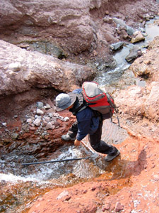
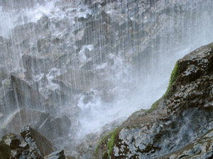
But we made our way slowly into the Copper River Valley, and past the steep spot at the end of the ridge. At this point David was horribly thirsty, so we bushwhacked our way into the nearest gully, and followed it back uphill to a waterfall. Despite the small gain in elevation to get up there, it was a beautiful spot for the break we all needed. We drank water, cooked food, had hot chai, and braver souls than I got wet in the waterfall.
We emerged to discover that we are still strangely not alone in this vast wilderness. A couple of subsistence hunters on ATVs were parked right in our path. So we chatted with them briefly, providing our thoughts of the locations of sheep, and hearing stories of swimming bears. |
 |
 |
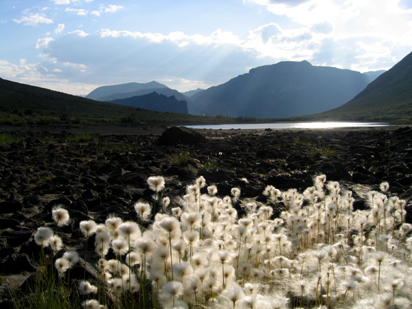
We're in the Copper River valley, ready to raft tomorrow. Wrangell and Sanford fill almost the whole of the skyline in the direction we're traveling, and I hope the smoke haze lifts further from their peaks. |
|