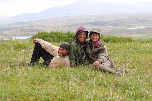
From June 7 through July 6, 2006, I spent a month hiking and packrafting through the lands downstream of the Pebble Mine. This 500-mile trip took us (myself, my husband, and a friend) on a loop of both watersheds draining from the Pebble site to Bristol Bay, the Nushagak and the Kvichak, and past many of the potentially affected villages. This page reprints the updates I wrote along the way and published in the Bristol Bay Times.
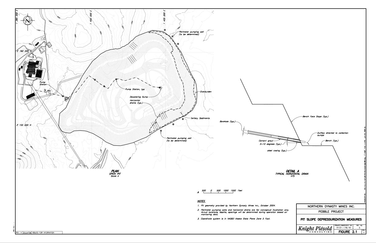
The Pebble Mine project is a controversial proposal by Northern Dynasty Minerals to build one of the largest gold and copper mines in the world, in southwest Alaska, near Lake Iliamna. Northern Dynasty has not yet applied for permits, but their current proposal involves both a large open pit and an underground mine, as well as removal of the water from the headwaters of Upper Talarik Creek and the Koktuli River ( important fish habitats). The site sits at the headwaters of two major Bristol Bay drainages ( Nushagak and Kvichak), and potentially poses a large threat to the region's water and salmon. This proposal has become a major political issue in Alaska, pitting pro-mining forces against local native villages and commercial and sport fishermen.
Scroll down for brief accounts of each leg of the trip, with photos.
Route Map - click for larger version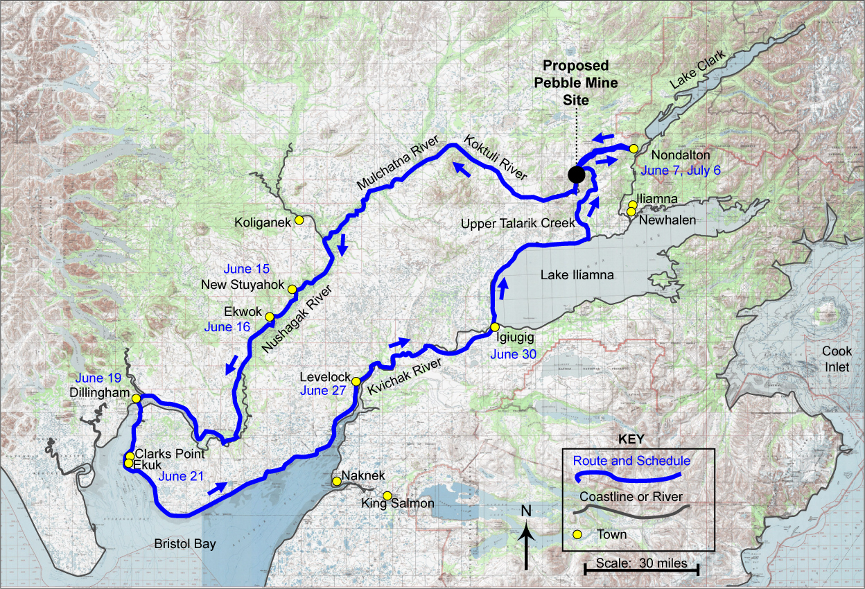
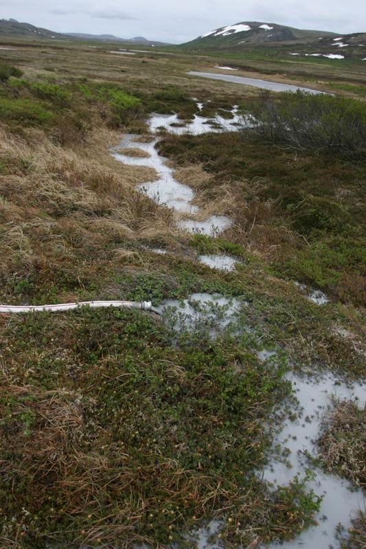
A hose pumps rock
slurry onto the trundra.
Click for enlargement.
Out of Frying Pan Lake, from the center of the proposed mine site, flows the Koktuli River. We put into the river in our tiny packrafts, and let the wind and current carry us downstream, through tundra and scrub willows chewed down by the beavers. As we floated out of the highlands, the tundra gave way to spruce forest along the banks. We joined the Swan River, then the Mulchatna, and finally the Nushagak. Moose started appearing along the banks once the wind died down. The Nushagak carried us faster than we'd hoped, and we've arrived in New Stuyahok a day early.
Everyone who lives here already knows all this. They spend their lives in this place. What I'm hoping, with this trip, is that I can help show this land to those who don't know it.
Drifting out of Ekwok, we crossed paths with the salmon beneath us, floating away from the mine site as they swam up towards it. Swarms of swallows flitted in and out of their holes in the bluffs, eating the even larger swarms of mosquitos. But in the middle of the river, few bugs reached us, and the Nushagak's 5mph current carried us quickly downstream. Puffy clouds filled the sky, and we were warmed by some of our first real sunshine of the trip.
Skiffs buzzed past us up and down the river, and the closer we got to the mouth of the Nushagak, the more fish camps and lodges dotted the banks. No one knows for sure what will happen to the salmon if the Pebble Mine is built. But everyone knows that the salmon are the heart of this region. Unfortunately, Tom snagged on the bottom and lost all his fishing line as he was trolling out of the raft, so we'll have to wait until later to try our own luck at catching some of the salmon.
The weather turned to rain, and with the wind against us, we packed up our boats and took a "shortcut" over the tundra to skip a bend at the mouth of the Nushagak River. But at high tide the next morning, we spent half an hour wading through the thigh deep marsh at the edge of the coast to get back to the water.
Riding into Dillingham on the dropping tide, our little rafts seemed lost in the vast expanse of water. After our eleven days of travel, the Pebble Mine site seems very far away. But some of the salmon swimming in this bay were born in the Koktuli River. Even here in Dillingham, some of the water flows from Frying Pan Lake.
Click for enlargement.
We're not the only ones who would prefer fish to dried food and granola bars. A bear came up to check out where we'd left our food one night, and just turned away, apparently preferring what the sea had to offer. Seeing those tracks in the sand, we were glad we hadn't slept with our food. This far from the mine site, not everyone we talked to knew much about the Pebble Mine. But just like everywhere else we've been on this trip, people were generous and helpful, and gave us some advice that we'd have done better to pay more attention to.
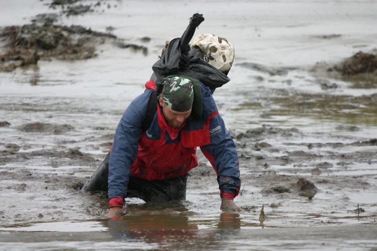
We were warned that there was a deep and muddy creek between Clark's Point and Ekuk. But we figured we could just wade across somehow. We ended up wandering around in the tidal sloughs behind Ekuk for at least an hour, looking for someplace to cross the mud.
Click for enlargement.
We ended up crawling on hands and knees through one thigh-deep patch of mud, and after that, the sloughs just kept pushing us inland. We wandered in to the mosquito-thick tundra just inland from the Kvichak, trying to escape the marshes and the mud, and ending up getting ourselves almost turned in a circle. It was a few miles off of our maps, but we ended up finding our way to Levelock no problem, and taking a much-needed shower with the gracious hospitality of the postmaster and his family.
Hopefully we'll find a less marshy way to walk up the rest of the Kvichak.
On the Kvichak River, about 5 miles downstream of Iguigig.
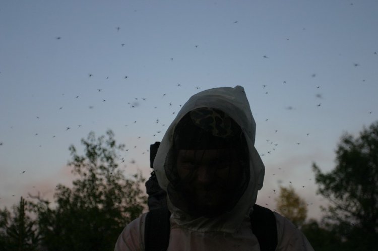
On our way out of Levelock, we paused half a day for Tom (who studies fosilized bones), to do a survey of the moose and caribou bones in Levelock creek. To make up the time, we walked the next day until 3AM, pushing ourselves to reach a relatively mosquito-free hilltop. The mosquitos have been intense.
Click for enlargement.
Our rafts have been less useful here than they were going downstream, but we've needed them to cross a number of the deep creeks feeding into the Kvichak.
Click for enlargement.
Tom's knees are sore from the lumpy tundra and squishy marsh, and we're hoping for nice beaches along Lake Iliamna.
Click for enlargement.
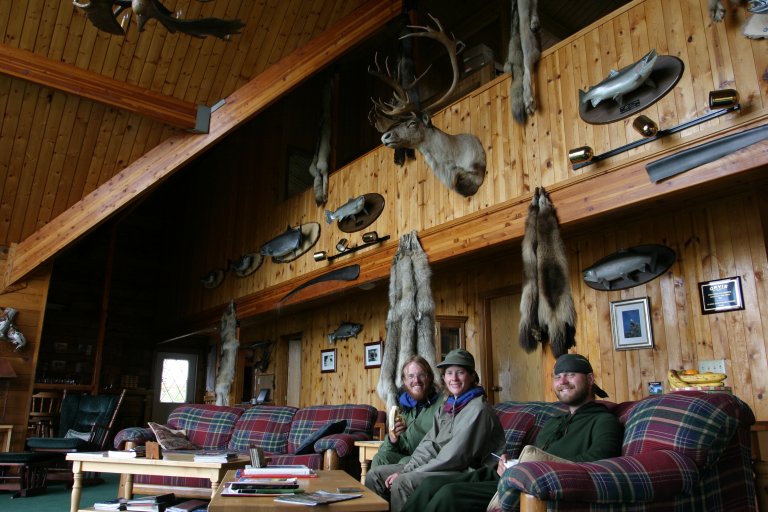
After a month of floating and walking , we're finished with our trek, and I'm writing this last update from my own computer, in Hig's hometown of Seldovia.
As we walked into Igiugig, the red salmon were just coming in from their own hard journey up the Kvichak, and we were given a beautiful salmon fillet from a woman cleaning fish on the shore. Opinions on the Pebble Mine are more mixed on this side of the drainage divide. With the right certifications, mining jobs can pay well, and though salmon are free, it takes a lot of work to get them.
Click for enlargement.
After the marshy banks of the Kvichak, Lake Iliamna's sand and gravel shores seemed like a highway. It almost felt like we were along the Bristol Bay beaches again, but for the mountains ringing the lake, and the strange absence of boats and cabins.
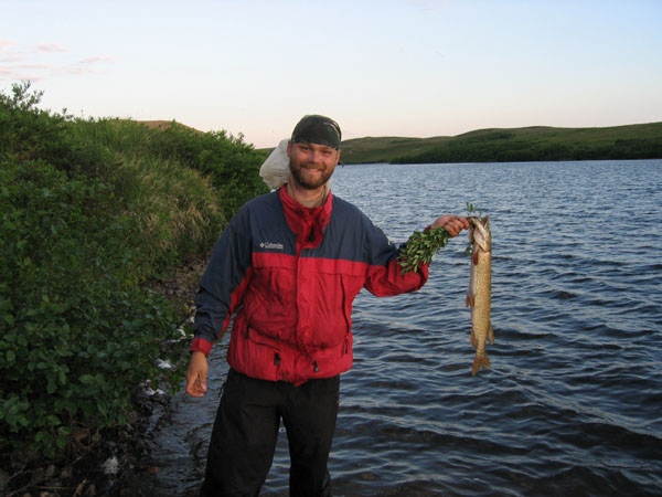
On this final leg of the trip, Tom's fishing rod finally came through, bringing us trout from Lake Iliamna, grayling from Upper Talarik Creek, and a northern pike from Frying Pan Lake - in the heart of the proposed tailings lake area.
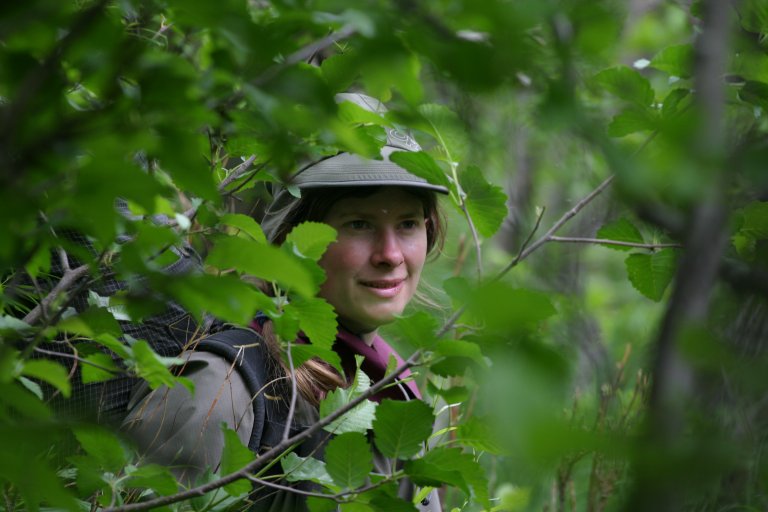
Heading up along the 4-wheeler trail on Upper Talarik Creek, we could see the mountains ringing the mine site again, and knew we were starting to come full circle. Upper Talarik Creek was one of the most beautiful areas we passed through on this trip, with tundra terraces overlooking a small rocky gorge. As we puffed our way up and down those terraces to avoid the alder, we really felt the difference from the flat walking we'd been doing all month.

Click for enlargement.
Mining claim stakes began to appear across the tundra as we got closer to the Pebble site, reminding me that as large as it could be, Pebble is only a tiny part of the proposed Bristol Bay mining district.
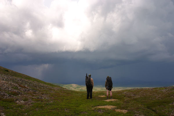
Looking down from the peaks surrounding the mine site valley, the drill rigs were just tiny specks in a valley of tundra and lakes, glowing brightly against the cloud of an approaching thunderstorm. We hunkered down on the side of the hill as the storm passed over us, hitting the peaks with lightening, and leaving Groundhog mountain covered in hail.
Click for enlargement.
Click for enlargement.
Almost a month from when we started, I again stepped over the small grassy channel at the headwaters of Upper Talarik Creek. We followed one river from the mine site to the ocean, and followed another one back. With one vast loop, our journey was complete.
If we'd had time, we'd have walked the proposed mining road out to Cook Inlet. But not this time.
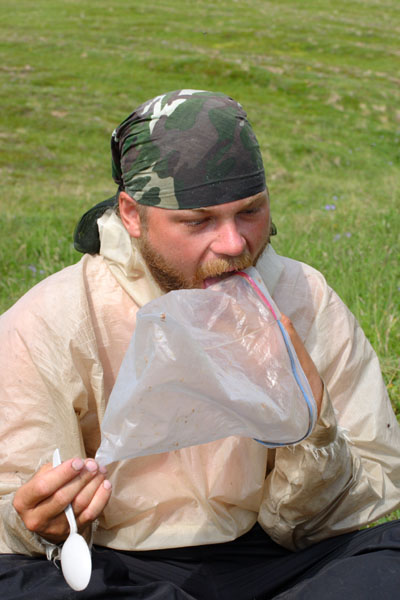
Hungry and tired, we licked the last of our food from its ziploc bags, and walked back into Nondalton, to tell the story of our journey to the rest of the world.
-Erin McKittrick
Read the guestbook | Sign the guestbook
All content by Erin McKittrick, copyright 2006-2007. Contact me with comments or questions at mckittre at gmail dot com.
Go to Alaska Trekking home. Go to Ground Truth Trekking home.
Last modified: 2/11/2007