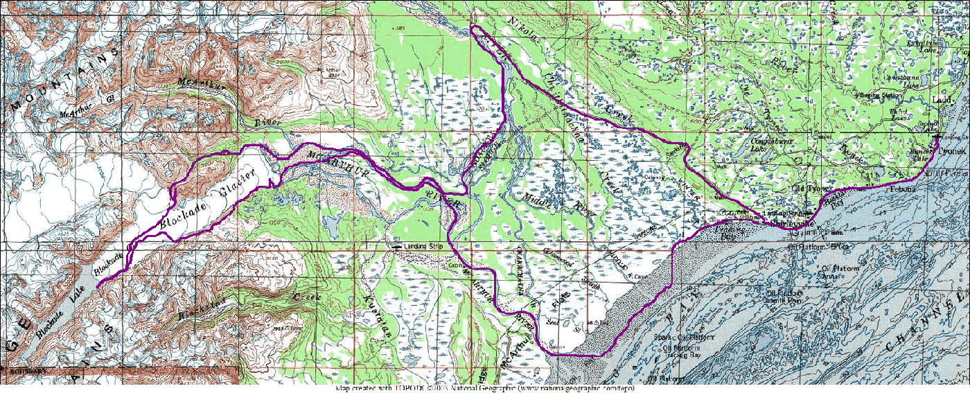
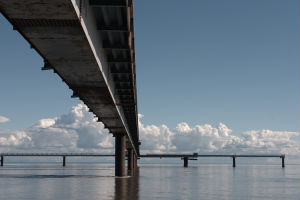
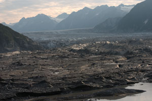
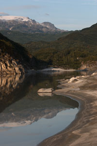
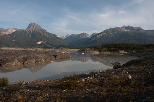
This started as a poorly conceived attempt to walk from Tyonek to Lake Clark, through Blockade pass. As you might have noticed "Blockade" and "pass" are not generally compatible terms. What we ended up doing was a very thorough tour of Blockade Glacier. It's a beautiful, awesome, and from the point of view of a traveler, frustrating place, which ends in the completely impassable Blockade Lake.
8/5/05 - day 1 |
| Leaving Tyonek, quickly |
|
We finally made it out of Seldovia today. After a day of waiting and two reschedulings we figured things out with our companions, swallowed the price of a chartered flight, and landed on Tyonek's dusty airstrip. The afternoon was sunny and warm, we successfully met up with Sue and Gordy, and we walked the short road into town, plotting our route out.
As it turns out, town is private. Ronald the lands enforcer rolled up on his 4-wheeler and accosted us at the post office. He was decked out in full hunting camo with a shotgun, and wanted to know whether we had permission to walk through Tyonek Native Corporation land. We didn't, of course. If I'd thought about it, I would have known some of the land was private, but we've had no problem walking through villages in the past, and have grown complacent. So he went off with a list of our names to "ask permission for us". Not only were we not allowed to walk on the land, we were trespassing by being in town at all, and he insisted we had to get right on the next flight to Anchorage. He even made our reservations.
We were pretty sure that the post office was actually federal property, and that it was highly unlikely that all the roads in town were private, but we didn't press the point. We smiled for his evidence photo, and watched as he drove around, telling everyone in town to make sure we got out of there.
|
|
So we got off their land as fast as we could. Straight down a gully to the beach. Everything below mean high tide is public property, and if we cheated by a few feet when the tide got high? Well, we were well beyond anyone's eyes by then.
We're camped on the beach by Granite point (with no granite in sight), at the edge of Tyonek land. Tomorrow we can hopefully hitch out the road and get off to proper hiking.
|
 |
|
8/6/05 - day 2 |
| Tyonek really wasn't very close to where we're going |
 |
Planning a trip with other people seems to lead to a breakdown of planning. We have a map with a scale, but haven't estimated total mileage or days for this route. Gordy estimated time, without looking at a map with a scale. He did bring a GPS, but we didn't include any coordinates on our map.
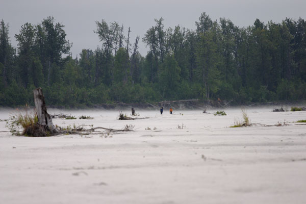
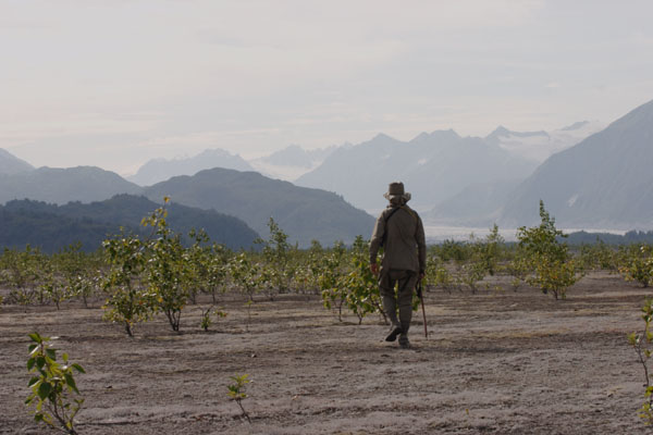
Tyonek was really nowhere near where we're going. After a mile and a half more beach walking, we found ourselves in Shirleyville, with 20 more miles of road left ahead of us. We managed to get a ride for the first five or six miles with a friendly oil worker we met in the Shirleyville galley, but the rest was all footwork.
The road was a straight flat ribbon of gravel, lined on both sides with a thin strip of alder. It was just about the most boring road possible. It was in good repair, but utterly lacking in either traffic, scenery, or landmarks. And also utterly failing to match up with its counterpart on our map. We figure we ended up walking five miles further up the Chackachatna River than we needed to.
|
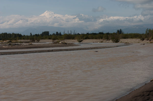
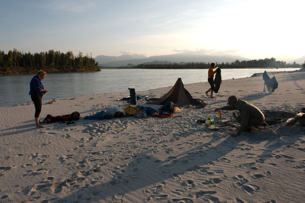
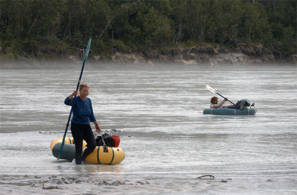
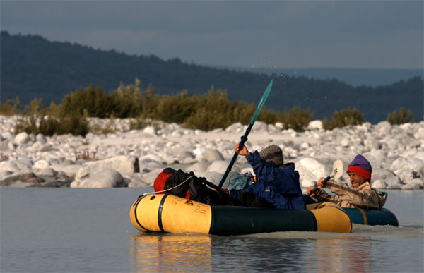
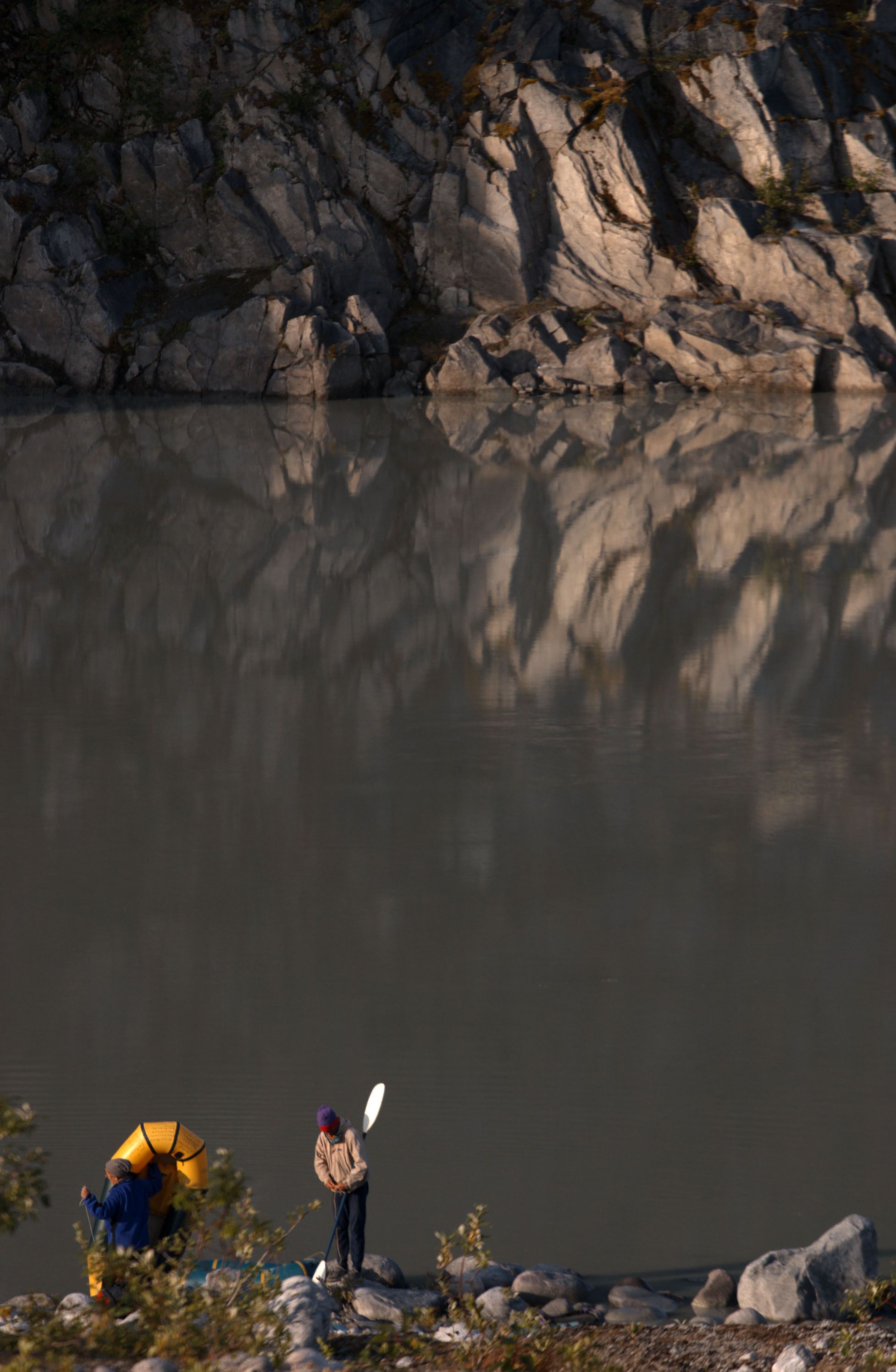
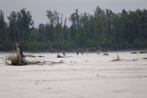
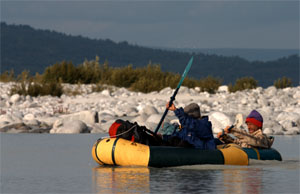
Luckily, the Chackachatna was a beautiful float. The warm sun shone on the silty brown river as it carried us along, weaving through gravel bars and cottonwood forest. A few waves swept their way into the boat, but we didn't hit any real rapids. The waves made it interesting for a little while, until we hit the lazy slough connecting the Chackachatna to the McArthur. The banks of the McArthur are sandy, and it was an easy evening's walk up to camp, along the beaches tracked by bear, wolf, fox, otter, and porcupine before us.
We're now about as close to Blockade Glacier as we'd have started out, had we flown in to the airstrip on the other side of the McArthur.
|
 |
 |
|
8/7/05 - day 3 |
| First doubts |
 |
 |
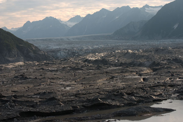
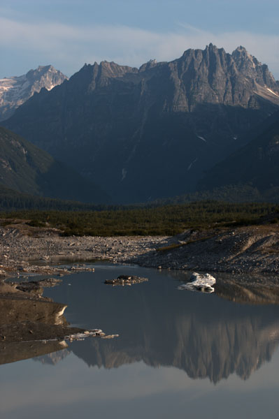
Here at the toe of Blockade Glacier, I'm starting to have my doubts about our route. Mostly what I doubt is the time. Hig, Gordy and I scouted out to the moraine overlooking the glacier front. The glacier's muddy toes were submerged in a lazy canal of water, which looks easily paddleable. Abobe the muddy toes, what we could see of the glacier looked crazed with crevasse lines. Maybe they're shallow grooves. Maybe they aren't. But the bushwhack up around the side of the glacier looks thick, steep, and aldery. If we avoid the glacier altogether, the slog around will probably take at least 14 hours of walking (my guess is 16-17). We do have crampons to try the crossing, though we almost lost them earlier today. Hopefully the glacier will smooth out up higher.
|
|
Today we walked the sandbars up the McArthur river, with only a few bushwhacks where the river butted up against the forest bank. On the first bushwhack, we swatted mosquitos and complained a little. On the second one, we debated extensively, went partway through, lost the crampons, and then rafted away across the
river.
The debate was over the crossing. Gordy wanted to quickly raft across to walk the sandbars on the other side. Hig and I though the sandbars would switch back and forth, and we'd waste more time with the rafting. We did waste time debating it, but Gordy was right. Before we realized this, we'd bushwhacked a ways up the river, and the Ursack full of crampons fell off of Gordy's pack. We didn't find out until and hour or two later, and had a 3.5 hour break while Gordy ran back to look for them.
|
 |
 |
 |
One thing at least that has been going right for us, is these riverbanks we've been walking. Vast flats of sand and scattered cottonwoods, the sand growing just a thin coat of lichens and mosses to stabilize it and make it a bit springy. It's perfect walking, perfect sleeping. A golf course.
|
 |
 |
 |
|
8/8/05 - day 4 |
| Scenic and sluggish |
 |
 |
 |
|
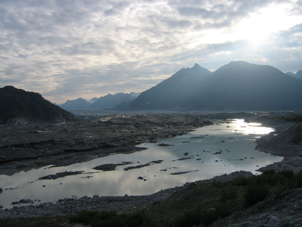
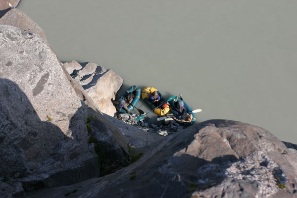
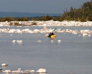
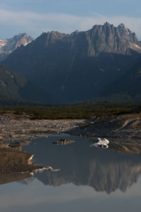
Today we did some paddling, some glacier walking, some scrambling, some bushwhacking, and some meadow traverses. All except the bushwhack was scenic and pleasant, but all of it was slow. We paddled up the canal to the nose of the glacier, and dinked around, scouting our options.
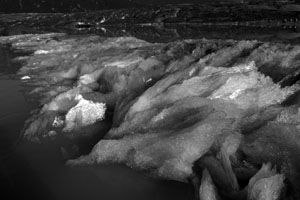
Cold springs welled up along the side of the glacier, coming up from deep under the ice. As the pressure drops, the water freezes, creating a dam of flaky crystals around a pool of ice water. Frazzle, it's called (according to the geologist).
|
 |
 |
 |
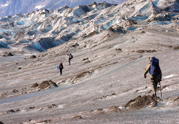
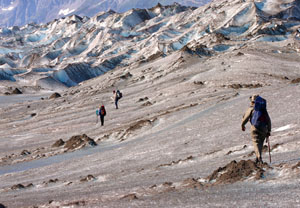
In the course of our scouting we found more discarded rockets, to go with the one we'd seen on the banks of the McArthur. Someone must have used this glacier for target practice. We finally decided opt for the glacier route, pulling the rafts up onto the toe, and strapping on our crampons.
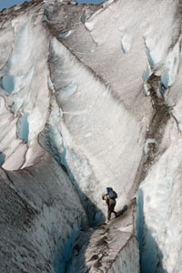
We charged out across the ice, stopping several times to redo the straps on my too-large and antiquated crampons. Then we charged right back again, as the fins of ice rose up into a maze around us. We found a great route for awhile along the left, but then it ended abruptly in a wall of icy cliffs. Hig valiantly hacked ice steps about halfway up one of the narrow fins, until it led him to an even steeper and more exposed slope. Grudgingly, we retreated to the rocks.
|
 |
 |
 |
|
The glacier has shrunk down 200-300 feet since the little Ice Age, and before we could even reach the bushwhack above, we had to negotiate that steep and crumbling slope of boulders and ice. We made a few false starts on the route, promptly lost Gordy (who was willing to climb sketchier routes than the rest of us), sent Hig to check up on him, and then all reunited in the alder after a couple of extra trips.
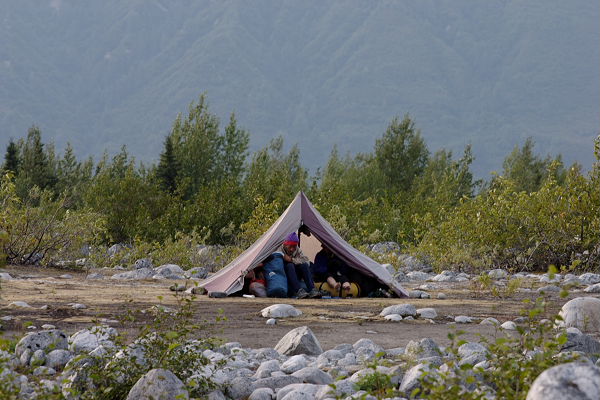
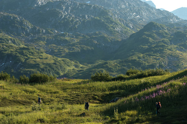
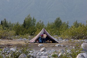
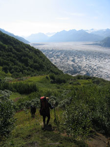
I led us through a bushwhack that was thankfully dotted with tall meadows of grass and fireweed. The grass was taller than me, and I could just barely peer ahead along the tops of the meadows as I swished through them. We pushed along once we got to the high country, tiring us all, but especially Sue. We're camped on a wonderful carpet of heather, and we think Hig probably will make it in time to catch his flight out of Anchorage, though it's closer than we'd like.
The weather's been excellent, and the glacier is as beautiful from above as it was from the ice. I am more than ready to sleep now, so the pictures will have to speak for me.
|
 |
 |
|