8/29/04 - day 5 | ||
|
Before it got dark, we could see across the valley to the hills that fill it and our pass across the way. And the hills that fill it do not match up with the lines on the map. The map already lost one hill, so I guess we shouldn't be surprised that it toggles a couple other hills and streams. As we were coming up the main valley we puzzled over a prominent knob across the way that was completely missing from our map. And as we got up to our side valley, it all became confusing. One lazy USGS employee with a few bad data points can create a lot of confusion when his views become official. The good thing about being confused is that it has led us up onto a hillside covered with hedgehog mushrooms. Tomorrow we're planning to push for an early start in the hope that we can make it to Valdez before the post office closes. If not, we have an extra day to wait since the ferry won't go on Wednesday morning. |
||
|
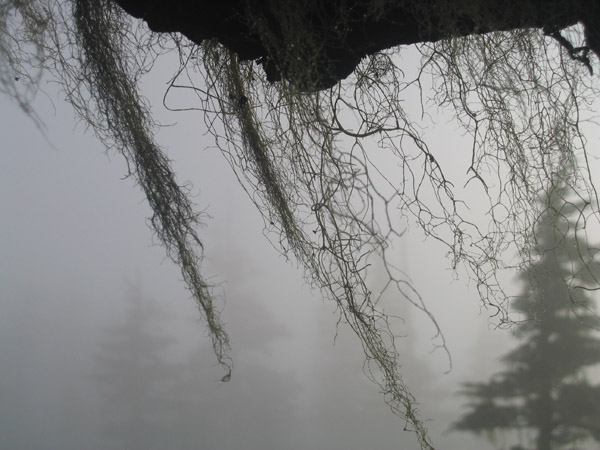
It wasn't far to the ocean this morning. We left our meadow in the morning fog, and scrambled down a wooded cliff. From the bottom of the cliff we could see the grey sheen of Port Fidalgo. We blew up our rafts in the breaking clouds and paddled under the sun into the deep inner cove. |
 |
|
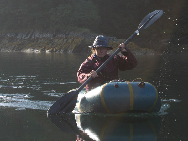 |
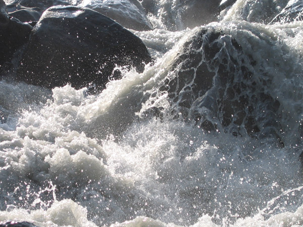
Our inner cove was connected to the main body of Port Fidalgo by a small channel in which we had been told there was a class 2 rapid. Of course we hit the water at a low and rising tide, where we could expect the current to be steadily increasing against us. And it was. |
|
|
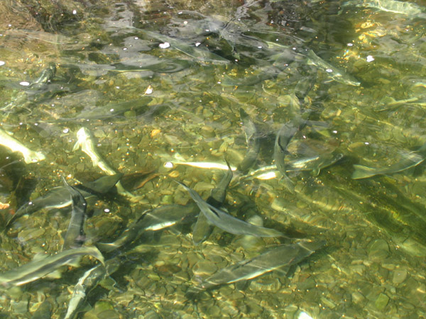
For the first part of the channel, we could still fight it fairly easily, and the low tide gave us the perfect view of all the sea stars, anemones, and other intertidal life coating the cliffs, as jellies drifted by, and salmon swam in the eddies. At the end of the channel we had to portage, and after crossing the shallow bay over eel grass and skittish flounders, the up bay current forced us out to walk. We walked the beaches as the tide rose to cut us off, and then followed an animal trail through the woods, which took us almost to our river flats. The river flats were all grass laced with bear trails and bear sleeping spots, as the bears wandered back and forth to eat the pink salmon in the side channels. And there were a lot of those, ugly and half-rotten, chewing each other in the shallows. Along with rotting salmon on the bank. |
 |
|
 |
The river up the valley wasn't nearly as nice as I had hoped. At first it was swampy, which could have been expected. And then it was a mess of a devil's club bushwhack around salmonberries and small trees. The difficulty varied, but it seemed for the whole lower half of the valley, that all the nice gravel bars were on the other side. | |
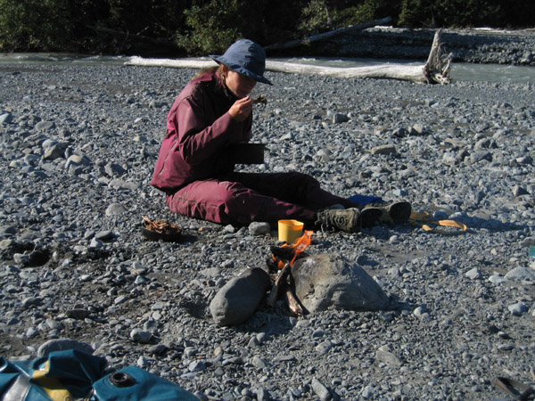 |
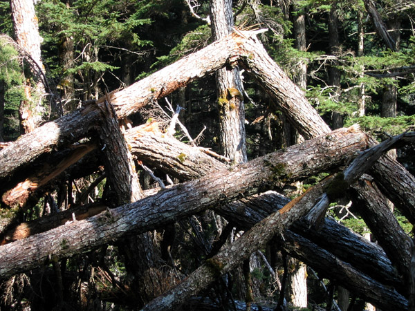
We cooked our last cooked meal at the first gravel bar on our side, sitting in the nice warm sun. And we did get some good gravel bars later. Until we hit the cliffs. There were three cliffs we had to scramble up and over, where the river crashed into the bank. None of them was very far, but a steep traverse through devil's club and salmonberries doesn't have to be far. It's a place where progress can be measured in feet per hour more easily than in miles per hour. And for all the times I've experienced devil's club, it only gets more annoying the next time. The end of the last scramble brought us to the confluence with our side valley. And the thick devil's club by the stream brought us up on the hillside. The confusion of the map and the great cliff below us kept us up here. We'll see what tomorrow will bring. |
|
8/30/04 - day 6 | ||
|
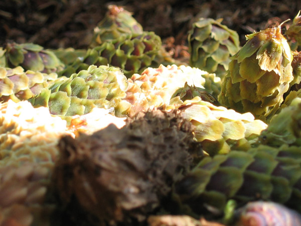
We're on our way out. We even woke up at 5:45 to see if we could maybe make it to Valdez today. But it was never likely, and the devil's club bushwhacks on the way to the pass soon killed any hope of that idea. This morning the world looked more like our map, assuming you allow the rivers to have moved around quite a bit. We headed away from our forested campsite at the crack of dawn with a full pot of hedgehog mushrooms to cook later. There were such good hedgehogs in the forest that it seemed a crime to ignore them, but our pot was already full. The forest was thick with all kinds of mushrooms, most of which probably sprung up since the rain a couple of days ago. I wish I knew more of the edible kinds. The topography was kind to us today. We hit no cliffs coming down from our ridge or up to the pass, and the other river in the valley was just barely foot crossable. The vegetation covering that topography was significantly less kind. We walked over spongy moss in open hemlock forest, but we also scrambled through long tracts of devil's club, alder, and salmonberries in avalanche gullies and up to our pass. | ||
|
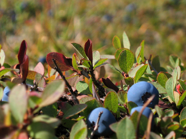
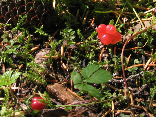
Then there were fields of fireweed and grass, and then suddenly we were alpine. As it was completely clear we couldn't make it to Valdez before the post office closed today, we decided to relax and enjoy it. It was sunny, warm, beautiful, and covered with blueberries. I am amazed at the sheer volume of berries a low-bush blueberry can put out. The plants can be squashed flat into the tundra, with leaves less than half a centimeter long, and still carry a dozen plump large blueberries. The volume of berries easily exceeds the above-ground volume of plant by several fold. |
 |
|
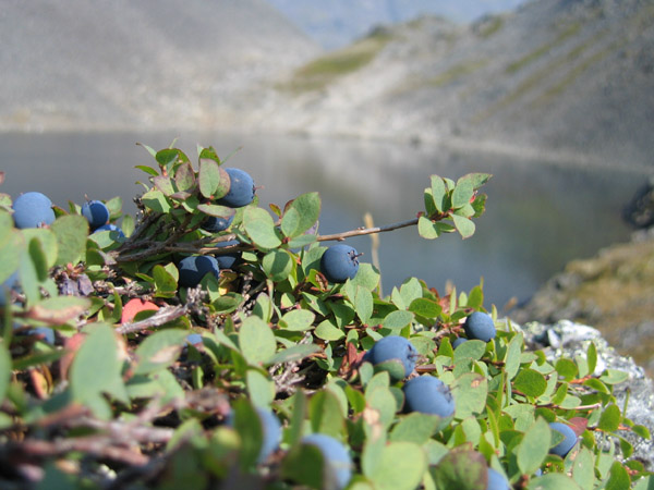 |
So we ate our way up to the lake in the pass, where we photographed blueberries, stuffed our faces, and made not a dent in them. They were everywhere and excellent, and I'm surprised more animals and birds don't take advantage of them. We rested there for awhile as Hig fixed the rip in the shoulder of his rain suit. He was trying to fix the other rip in his rain suit tonight in the sleeping bag, but I think he got fed up and didn't finish it. |
 |
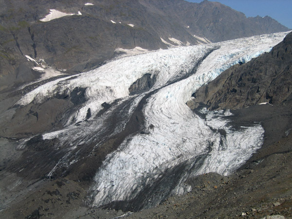
Down from the pass we watched glaciers emerge, shining white and crevassed as they peered over the cliff face. This side has more recently been scoured by glaciers, and though it left us with no blueberries, the walking has been much easier in general. We've had more rocks and more tundra, and now we're following some gravelly braid plains. Neither this river nor the one we ascended on the other side has a name on the map. The names end at the beach, and we are up in no man's land. |
 |
 |
 |
We have about 6 miles to go tomorrow before we hit a large river. The river parallels the road to Valdez, and from there we can always hitchhike. I don't know what the forest will bring for those first 6 miles, but I hope it is relatively fast. Or we will be very hungry when we arrive in town. Our day-long detour in the alpine may have cost us good coordination with the ferry, or we many have lost that anyway with other difficulties. But it definitely cost us food. We have little left, and as delicious as the pot of mushrooms was, its calories are insignificant. Blueberries are also not much of a help. I will be hungry for dinner in Valdez tomorrow, and hungrier still if we can't get there. |
|
8/31/04 - day 7 | ||
|
It's 2 in the morning, and we've been using our hotel room more for its amenities than for its potential for sleep. We have electricity, shower, a microwave, a fridge, a television, and nice soft large beds without any holes, which I am looking forward to sleeping on. Eve n television, which I never watch at home, can be a fun novelty at times like this. We were lucky to make it to Valdez at all today. Hig and I had a bet on for the first shower about whether we would or not. Being ever the optimist, he won, and I was happy for it. Mostly because of the food. With all our detours and difficulties, we had very little food left for today, and I was hungry all day, with flashes of crankiness and periods of unexpected tiredness from lack of food. Today was a day of gradually increasing speed. We traveled quite quickly for most of the distance to town, and quite slowly for most of the time. | ||
|
One step faster: The conifer forest did come through for us, and it saved us in the end. The alder patches disappeared, the traverse down through the steep patch was easy, and the forest wasn't bad walking. We still couldn't tell where we were, since we had only a very large scale map to follow, and some of the topo lines faded into their green background, while others disappeared behind the label "underground". The label referred to the oil pipeline, but unlike the pipeline itself, it spanned a good 1/2 mile by 4 mile chunk of topography. |
 |
|
 |
Even if we couldn't accurately tell where we were, at least we could get there. We followed the valley above the cliff of the gorge, skirting avalanche falls, and walking through great piles of mushrooms. We filled a gallon ziploc of hedgehogs before we stopped picking, and I could easily have filled my pack. But the forest still had ear-biting insects which flocked to Hig and drove him insane, and it had my nemesis the devil's club. Most importantly, it had no food, other than a few mushrooms and berries. I wanted to get to Valdez. |
 |
|
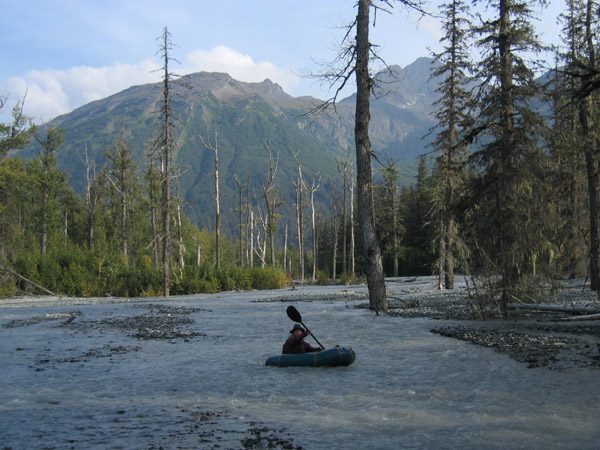
Two steps faster: An animal trail finally led us down to the river's edge, on a gravel bar, but still in the gorge. Power lines crossed the river over our heads, and the end of the gorge was in sight. We were able to raft and portage our way down the last remnants of gorge, and then we were flying through the braid plain. We zipped under a strange metal bridge that must have held the pipeline, and then the river disappeared into the cottonwood forest. It braided out shallowly, flowing around gravel bars and trees, leaving not much room for even our rafts. I needed food to keep going, and it was shallow and full of sharp stick obstacles. After a short blood sugar break, we portaged our way across the gravel, carrying the awkward load of tied together raft, string, pack, and paddle. Luckily it wasn't far to the Lowe river. |
 |
|
 |
Three steps faster: It was the first thing we'd hit since Port Fidalgo that had a name on the map, and we could see cars zooming by on the highway on its far bank. As rivers go, it was easy and pleasant to raft. It moved us quickly around gravel bars, logs, and stumps, forcing some tricky channel-choosing, and leading to a few butt bumps on the gravel. | |
|
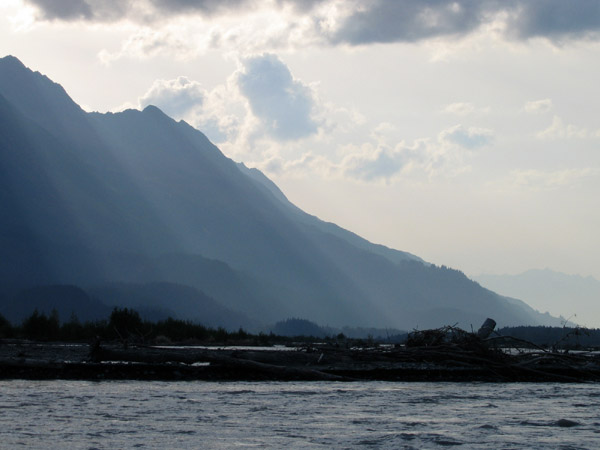
On a better and earlier day, we would have rafted to the ocean, and paddled the bay to valdez. But the day was waning, we were cold and wet, nad visions of restaurant meals danced in my head. So we pulled out, shoved all the wet sandy gear in our packs, and ditched to the highway. We crossed the road and took a few steps along it, discussing how difficult it might be to catch a ride. The discussion was quickly interrupted by a passing car, pulling over to stop at the sight of our upturned thumbs. Terminal speed: We zoomed along the highway in the culmination of our ever-increasing speed to Valdez, chatting with the local guy who'd picked us up. Not only did he give us a lift into town, he gave us a tour of town, pointing out ferry docks, restaurants,and lodging. He even gave us his tips on the likely cheapest lodging, a cheap good place to eat and how to get the most food for our money by correctly arranging the salad bar ingredients, and dropped us off at the restaurant door. We couldn't have been more lucky. | ||